
IMAGES TAKEN NEAR TO
Coleshill Street, FLINT, CH6 5BQ
Introduction
This page details the photographs taken nearby to Coleshill Street, CH6 5BQ by members of the Geograph project.
The Geograph project started in 2005 with the aim of publishing, organising and preserving representative images for every square kilometre of Great Britain, Ireland and the Isle of Man.

There are currently over 7.5m images from over14,400 individuals and you can help contribute to the project by visiting https://www.geograph.org.uk
Image Map
Images are licensed for reuse under creativecommons.org/licenses/by-sa/2.0
Notes
- Clicking on the map will re-center to the selected point.
- The higher the marker number, the further away the image location is from the centre of the postcode.
Image Listing (268 Images Found)
Images are licensed for reuse under creativecommons.org/licenses/by-sa/2.0
Image
Details
Distance
1
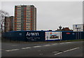
Fenced-off Llys Raddington building site near multi-storey flats, Flint
Viewed in mid January 2017. The notice on the fence shows Llys Raddington - Coming Soon - Extra Care Scheme. Live an independent life style with care and support. A development of 73 one and two bedroom high quality apartments.
The depiction shows a 4-storey building. The multi-storey flats are behind the building site.
Image: © Jaggery
Taken: 16 Jan 2017
0.01 miles
2
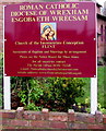
Church of the Immaculate Conception nameboard, Flint
On the left here. http://www.geograph.org.uk/photo/5257128
Image: © Jaggery
Taken: 16 Jan 2017
0.01 miles
3
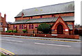
Roman Catholic church, Coleshill Street, Flint
Viewed from the corner of Earl Street. Part of the Roman Catholic Diocese of Wrexham, the red brick building opened for worship in 1885. The name behind the street name sign on the right is St Mary's Catholic Church whereas the nameboard http://www.geograph.org.uk/photo/5257154 on the left side shows Church of the Immaculate Conception, Flint.
Image: © Jaggery
Taken: 16 Jan 2017
0.02 miles
4
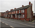
Coleshill Street houses, Flint
Viewed across the A5119 Coleshill Street near the Church Street junction.
Image: © Jaggery
Taken: 16 Jan 2017
0.03 miles
5
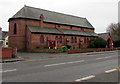
Catholic Church in Flint
Part of the Roman Catholic Diocese of Wrexham, the red brick building alongside the A5119 opened for worship in 1885. Confusingly, there are two names here. The board on the left http://www.geograph.org.uk/photo/5257154 shows Church of the Immaculate Conception, Flint. The name sign on the right shows St Mary's Catholic Church. http://www.geograph.org.uk/photo/5257164
Image: © Jaggery
Taken: 16 Jan 2017
0.03 miles
6

Flint Library clock tower
Viewed across the A5119. Different times are displayed on each clock face, both wrong.
Image: © Jaggery
Taken: 16 Jan 2017
0.03 miles
7
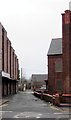
Swinchiard Lane, Flint
This part of Swinchiard Lane is between the derelict former Plaza Cinema http://www.geograph.org.uk/photo/5257490
on the left and St John's United Reformed Church http://www.geograph.org.uk/photo/5256978 on the right.
Image: © Jaggery
Taken: 16 Jan 2017
0.03 miles
8
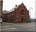
St John's United Reformed Church, Church Street, Flint
The nameboard shows St John's Flint with Bagillt United Reformed Church, part of the Dee Valley Pastorate. Foundation stones in the wall are dated September 28th 1927.
Image: © Jaggery
Taken: 16 Jan 2017
0.03 miles
9
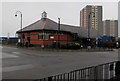
Flint Library, Flint
Part of the Flintshire County Council Library Service, on the corner of Church Street and Aber Road.
Image: © Jaggery
Taken: 16 Jan 2017
0.04 miles
10
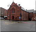
St John's United Reformed Church, Church Street, Flint
The nameboard shows St John's Flint with Bagillt United Reformed Church, part of the Dee Valley Pastorate. Foundation stones in the wall are dated September 28th 1927.
Image: © Jaggery
Taken: 16 Jan 2017
0.04 miles