IMAGES TAKEN NEAR TO
Chester Road, FLINT, CH6 5BF
Introduction
This page details the photographs taken nearby to Chester Road, CH6 5BF by members of the Geograph project.
The Geograph project started in 2005 with the aim of publishing, organising and preserving representative images for every square kilometre of Great Britain, Ireland and the Isle of Man.

There are currently over 7.5m images from over14,400 individuals and you can help contribute to the project by visiting https://www.geograph.org.uk
Image Map
Images are licensed for reuse under creativecommons.org/licenses/by-sa/2.0
Notes
- Clicking on the map will re-center to the selected point.
- The higher the marker number, the further away the image location is from the centre of the postcode.
Image Listing (7 Images Found)
Images are licensed for reuse under creativecommons.org/licenses/by-sa/2.0
Image
Details
Distance
1
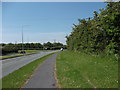
A548 heading towards Y Fflint
Dual carriageway about to become one so that it can squeeze through Flint.
Image: © John Haynes
Taken: 22 May 2012
0.17 miles
2

Wild flowers by NCN5 and Chester Road, Oakenholt
Image: © David Smith
Taken: 6 May 2023
0.17 miles
4
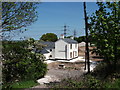
Glantraeth Fferm
Newly gentrified farm house surrounded with a builders yard.
Image: © John Haynes
Taken: 22 May 2012
0.22 miles
5
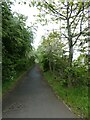
NCN5 at Rockcliffe
This path follows the former winding route of Chester Road (A548)
Image: © David Smith
Taken: 6 May 2023
0.22 miles
6
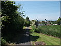
Llwybr Arfordir Cymru
The Wales Coast Path and National Cycle Route 5 heading westward.
http://www.ccgc.gov.uk/enjoying-the-country/wales-coast-path.aspx?lang=cy-gb
http://www.ccw.gov.uk/enjoying-the-country/wales-coast-path.aspx?lang=en
http://www.sustrans.org.uk/what-we-do/national-cycle-network/route-numbering-system/route-5#351024,298570
Image: © John Haynes
Taken: 22 May 2012
0.23 miles