IMAGES TAKEN NEAR TO
Stanney Lane, ELLESMERE PORT, CH65 9AH
Introduction
This page details the photographs taken nearby to Stanney Lane, CH65 9AH by members of the Geograph project.
The Geograph project started in 2005 with the aim of publishing, organising and preserving representative images for every square kilometre of Great Britain, Ireland and the Isle of Man.

There are currently over 7.5m images from over14,400 individuals and you can help contribute to the project by visiting https://www.geograph.org.uk
Image Map
Images are licensed for reuse under creativecommons.org/licenses/by-sa/2.0
Notes
- Clicking on the map will re-center to the selected point.
- The higher the marker number, the further away the image location is from the centre of the postcode.
Image Listing (11 Images Found)
Images are licensed for reuse under creativecommons.org/licenses/by-sa/2.0
Image
Details
Distance
1
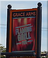
Sign for the Grace Arms, Ellesmere Port
See Image] for context.
Image: © JThomas
Taken: 14 Sep 2019
0.03 miles
2
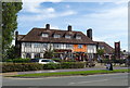
The Grace Arms, Ellesmere Port
On Stanney Lane.
Image: © JThomas
Taken: 14 Sep 2019
0.04 miles
3
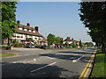
The Grace Arms, Stanney Lane
The Grace Arms, named after the family who owned Whitby Hall in the park opposite.
Image: © Sue Adair
Taken: 3 May 2007
0.04 miles
6
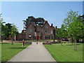
Whitby Hall
Local landowner, John Grace, built Whitby Hall in 1860, an elegant residence for his family set in 42 acres of parkland. The surrounding land was sold within eleven years leaving just 3 acres of garden which, along with the hall, stayed in the family until 1931 when it was sold to the local council. The building became the town's administrative centre and the gardens were opened as a public park but in the 1990's the local authority moved premises and the neglected hall became derelict and vandalised. Funding was secured from the lottery, the park was upgraded and in 2003 the hall opened as a cultural centre and base for a local theatre company.
Image: © Sue Adair
Taken: 3 May 2007
0.22 miles
7
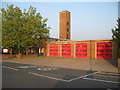
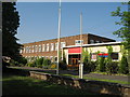
Ellesmere Port fire station
A view looking east towards the fire station.
Image: © Phil Williams
Taken: 8 Jun 2007
0.22 miles
8
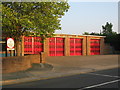
Fire station at Ellesmere Port
A view looking to the southeast towards the fire station.
Image: © Phil Williams
Taken: 8 Jun 2007
0.22 miles