
IMAGES TAKEN NEAR TO
West Vale, NESTON, CH64 9SF
Introduction
This page details the photographs taken nearby to West Vale, CH64 9SF by members of the Geograph project.
The Geograph project started in 2005 with the aim of publishing, organising and preserving representative images for every square kilometre of Great Britain, Ireland and the Isle of Man.

There are currently over 7.5m images from over14,400 individuals and you can help contribute to the project by visiting https://www.geograph.org.uk
Image Map
Images are licensed for reuse under creativecommons.org/licenses/by-sa/2.0
Notes
- Clicking on the map will re-center to the selected point.
- The higher the marker number, the further away the image location is from the centre of the postcode.
Image Listing (13 Images Found)
Images are licensed for reuse under creativecommons.org/licenses/by-sa/2.0
Image
Details
Distance
1
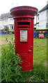
Elizabeth II postbox on Burton Road, Neston
Postbox No. CH64 386.
Image: © JThomas
Taken: 25 May 2019
0.13 miles
2
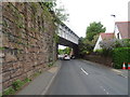
Railway bridge over Burton Road, Little Neston
Looking north west.
Image: © JThomas
Taken: 25 May 2019
0.14 miles
3
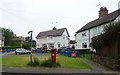
Houses on Burton Road, Neston
Showing position of Postbox No. CH64 386.
Image: © JThomas
Taken: 25 May 2019
0.15 miles
4
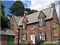
Schoolmaster's House, Little Neston
The Schoolmaster's house in Burton Road, Little Neston was built in 1840, enlarged and converted to the Presbytery of St Winefride's Church in 1843.
Image: © Sue Adair
Taken: 21 Jul 2010
0.15 miles
5
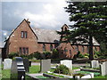
St Winefride's Church - Little Neston
St. Winefride's RC Church in Burton Road, Little Neston, built in 1843.
Image: © Sue Adair
Taken: 21 Jul 2010
0.17 miles
6
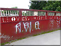
"...leaves, whisper or breeze..."
Second part of an inscription on the bridge where the Wirral Way (National Cycle Network, route 56) crosses Bridge Street, Neston. For the rest of the verse, see Image and Image
Image: © Oliver Dixon
Taken: 4 Jun 2014
0.23 miles
8
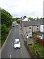
Bridge Street, Neston
Looking south from the footbridge which carries the Wirral Way.
Image: © Oliver Dixon
Taken: 4 Jun 2014
0.23 miles
9
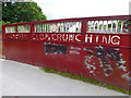
"Clickerty clop, crunching..."
First part of an inscription on the bridge where the Wirral Way (National Cycle Network, route 56) crosses Bridge Street, Neston. For the rest of the verse, see Image and Image
Image: © Oliver Dixon
Taken: 4 Jun 2014
0.23 miles
10
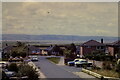
Stratford Road, Little Neston
The River Dee and the coast of North Wales are in the background.
Image: © M J Roscoe
Taken: Unknown
0.24 miles