1
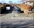
Millfield, Neston
The SE end of Millfield viewed across the B5136 Liverpool Road.
Image: © Jaggery
Taken: 15 Feb 2018
0.15 miles
2
Junction of Mayfield Gardens and Liverpool Road, Neston
Viewed across the B5136 Liverpool Road.
This is one of two junctions of these roads in Neston.
The other one is 200 metres to the NE. https://www.geograph.org.uk/photo/5837324
Image: © Jaggery
Taken: 15 Feb 2018
0.17 miles
3
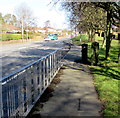
Liverpool Road near Mayfield Gardens
Image: © Colin Pyle
Taken: 28 Feb 2015
0.19 miles
4
Liverpool Road pelican crossing, Neston
Chambers Dictionary states that pelican in this context is adapted from "pedestrian light controlled crossing".
Image: © Jaggery
Taken: 15 Feb 2018
0.19 miles
5
Liverpool Road telecoms cabinets, Neston
Alongside the B5136 Liverpool Road.
Image: © Jaggery
Taken: 15 Feb 2018
0.19 miles
6
Bungalows above Liverpool Road, Neston
Originally, bungalow was used in English for a lightly-built house, with a veranda and one storey.
In current UK usage it is a convenient word for any one-storey dwelling.
Image: © Jaggery
Taken: 15 Feb 2018
0.19 miles
7
Liverpool Road, Neston
Liverpool Road looking in the direction of Chester High Road.
Image: © Sue Adair
Taken: 3 Jun 2006
0.20 miles
8
Ivy Cottages, Liverpool Road, Neston
A plaque on the wall shows IVY COTTAGES 1899.
Image: © Jaggery
Taken: 15 Feb 2018
0.20 miles
9
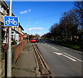
Cycle route sign, Liverpool Road, Neston
At the edge of Ivy Cottages, the sign is on the lamppost on the left here. https://www.geograph.org.uk/photo/5731154
Image: © Jaggery
Taken: 15 Feb 2018
0.20 miles
10
Neston conservation area - please drive carefully
The County of Cheshire sign is on the grass alongside the B5136 Liverpool Road
Image: © Jaggery
Taken: 15 Feb 2018
0.21 miles


