
IMAGES TAKEN NEAR TO
Ringway, NESTON, CH64 3RT
Introduction
This page details the photographs taken nearby to Ringway, CH64 3RT by members of the Geograph project.
The Geograph project started in 2005 with the aim of publishing, organising and preserving representative images for every square kilometre of Great Britain, Ireland and the Isle of Man.

There are currently over 7.5m images from over14,400 individuals and you can help contribute to the project by visiting https://www.geograph.org.uk
Image Map
Images are licensed for reuse under creativecommons.org/licenses/by-sa/2.0
Notes
- Clicking on the map will re-center to the selected point.
- The higher the marker number, the further away the image location is from the centre of the postcode.
Image Listing (7 Images Found)
Images are licensed for reuse under creativecommons.org/licenses/by-sa/2.0
Image
Details
Distance
1
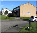
Corner of Liverpool Road and Westlands Close, Neston
The car is in Westlands Close.
Image: © Jaggery
Taken: 15 Feb 2018
0.14 miles
2
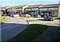
Westlands Close, Neston
Cul-de-sac set back from the east side of Liverpool Road.
Image: © Jaggery
Taken: 15 Feb 2018
0.16 miles
3
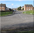
Junction of Ringway and Liverpool Road, Neston
The SW corner of Ringway viewed across the B5136 Liverpool Road. Measuring about 175 metres by 175 metres, Ringway is a roughly square area of houses.
On the Neston Past website, Susan Chambers records that the Ringway housing estate had interesting origins as HMS Mersey in World War II. The site was classified as a T124x shore-based naval establishment, associated with the Admiralty taking over merchant navy vessels during the war years.
For five years during the war, the 22 acre site housed a community with accommodation that included sick bays, a medical unit, kitchens, restaurant, a cinema, garages, stores, administration buildings, ward-rooms, cells, a captain's office, laundry, fuel dump and hutments for living accommodation. At the end of the war there were 52 buildings, most of which had been communal hutments, that were considered suitable for adaption to temporary residential use at a time when there was a desperate need for housing, partly because of prewar demolition in the Neston area.
Image: © Jaggery
Taken: 15 Feb 2018
0.17 miles
4
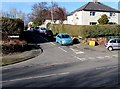
Junction of Liverpool Road and Mayfield Gardens, Neston
Viewed across the B5136 Liverpool Road.
This is one of two junctions of these roads in Neston.
The other one is 200 metres to the SW. https://www.geograph.org.uk/photo/5837334
Image: © Jaggery
Taken: 15 Feb 2018
0.22 miles
5
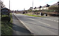
Welcome to Neston - historic market town
The sign faces the B5136 Liverpool Road opposite Mayfield Gardens.
Image: © Jaggery
Taken: 15 Feb 2018
0.22 miles
6
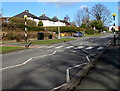
Zebra crossing, Liverpool Road, Neston
Across the B5136 Liverpool Road opposite Mayfield Gardens. Although Belisha beacons had marked pedestrian crossings in the UK from 1934, it was not until 1951 that the now familiar black and white stripes stretching across the width of the road were officially introduced. Previously, there were only metal studs across the road surface.
Image: © Jaggery
Taken: 15 Feb 2018
0.24 miles
7
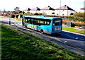
Arriva Merseyside bus, Liverpool Road, Neston
The bus from Liverpool heads towards Neston town centre.
Image: © Jaggery
Taken: 15 Feb 2018
0.24 miles