
IMAGES TAKEN NEAR TO
Brimstage Road, WIRRAL, CH63 6HD
Introduction
This page details the photographs taken nearby to Brimstage Road, CH63 6HD by members of the Geograph project.
The Geograph project started in 2005 with the aim of publishing, organising and preserving representative images for every square kilometre of Great Britain, Ireland and the Isle of Man.

There are currently over 7.5m images from over14,400 individuals and you can help contribute to the project by visiting https://www.geograph.org.uk
Image Map
Images are licensed for reuse under creativecommons.org/licenses/by-sa/2.0
Notes
- Clicking on the map will re-center to the selected point.
- The higher the marker number, the further away the image location is from the centre of the postcode.
Image Listing (28 Images Found)
Images are licensed for reuse under creativecommons.org/licenses/by-sa/2.0
Image
Details
Distance
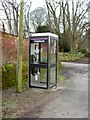
2
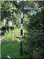
Old Direction Sign - Signpost by the A5137, Brimstage Road
Ball finial - 1 arm; Wirral Footpath post by the A5137, in parish of Bebington (Wirral District), South side of Brimstage Road just East of Old Hall Farm.
Column inscription reads:-
: ERECTED BY (WIRR)ALL FOOTPATHS SOCIETY BY CONSENT OF THE COUNTY COUNCIL :
N.B. The column appears to have been shortened or altered hence "WIRR" being missing. The "ALL" is a misspelling of Wirral, as seen on other posts.
Plate inscription reads:-
: PUBLIC FOOTPATH / TO THORNTON HOUGH :
Merseyside HER.
https://www.heritagegateway.org.uk/Gateway/Results_Single.aspx?uid=3314366&resourceID=1970
Surveyed
Milestone Society National ID: CH_SJ3082
Image: © John S Turner
Taken: 17 Sep 2016
0.02 miles
3
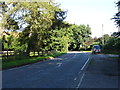
Brimstage Road (A5137), Brimstage
Towards Junction 4, M53 Motorway.
Image: © JThomas
Taken: 14 Sep 2019
0.03 miles
4
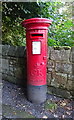
George V postbox on Brimstage Road, Brimstage
Postbox No. CH63 18.
Image: © JThomas
Taken: 14 Sep 2019
0.04 miles
5
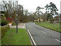
Brimstage Village
The first view of Brimstage as you travel from the motorway. The cream building in the middle of the green is now a nursery.
Image: © David Quinn
Taken: 8 Feb 2008
0.04 miles
6
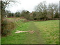
Footpath near Brimstage
View of the footpath between Brimstage and Thornton Hough, looking towards Brimstage.
Image: © David Quinn
Taken: 8 Feb 2008
0.06 miles
7
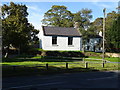
The old school house at Brimstage
On Greenbank.
Image: © JThomas
Taken: 14 Sep 2019
0.06 miles
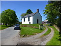
10
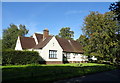
Day Nursery, Brimstage
On Brimstage Road (A5137).
Image: © JThomas
Taken: 14 Sep 2019
0.07 miles