
IMAGES TAKEN NEAR TO
Quarry Avenue, WIRRAL, CH63 3HF
Introduction
This page details the photographs taken nearby to Quarry Avenue, CH63 3HF by members of the Geograph project.
The Geograph project started in 2005 with the aim of publishing, organising and preserving representative images for every square kilometre of Great Britain, Ireland and the Isle of Man.

There are currently over 7.5m images from over14,400 individuals and you can help contribute to the project by visiting https://www.geograph.org.uk
Image Map
Images are licensed for reuse under creativecommons.org/licenses/by-sa/2.0
Notes
- Clicking on the map will re-center to the selected point.
- The higher the marker number, the further away the image location is from the centre of the postcode.
Image Listing (13 Images Found)
Images are licensed for reuse under creativecommons.org/licenses/by-sa/2.0
Image
Details
Distance
1
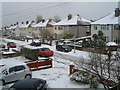
Snow in Fairacres
Fairacres Road, Bebington
Image: © Peter Bruffell
Taken: 12 Mar 2006
0.04 miles
2
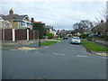
Feilden Road joins Church Road in Bebington
Image: © Raymond Knapman
Taken: 4 Apr 2014
0.11 miles
3
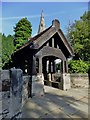
Lych gate to St Andrew's Church Bebington
Entrance to a Grade I listed building, the top of the spire showing above the gate.
Image: © Richard Hoare
Taken: 7 Aug 2013
0.16 miles
4
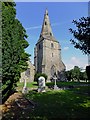
St Andrew's Church Bebington
A Gothic styled Anglican church it is designated by English Heritage as a Grade I listed building completed 1847.
A church built from local Storeton sandstone was present here before the Norman Conquest.
Image: © Richard Hoare
Taken: 7 Aug 2013
0.17 miles
5
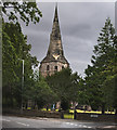
St Andrew's Church
This is a Grade I listed building. The architectural historian Raymond Richards considers it to be the finest old parish church in Wirral. It is an active Anglican parish church in the diocese of Chester, the archdeaconry of Chester and the deanery of Wirral North. https://en.wikipedia.org/wiki/St_Andrew%27s_Church,_Bebington
Image: © Ian Greig
Taken: 28 Jul 2017
0.17 miles
6
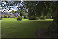
A small patch of open space on the corner of Cross Lane and Stanton Road
Image: © Ian Greig
Taken: 1 Sep 2017
0.19 miles
7
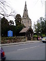
St Andrew's Church, Bebington
Built in sandstone the church is a Grade 1 listed building. The tower was rebuilt in 1805 after being struck by lightning.
Image: © Peter Holmes
Taken: 3 Mar 2010
0.20 miles
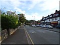
9
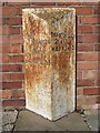
Old Milepost by the B5136, Church Road, Bebington
Cast iron post by the B5136, in parish of BEBINGTON (WIRRAL District), Church Road; between Lynton Drive and Foxcovers Road, on path, back to wall, on West side of road. Cast iron CCC1896, erected by the County Council in the 19th century.
Inscription reads:-
: LOWER / BEBINGTON / ¼ MILE / NEW FERRY 2 / BIRKENHEAD 3¾ : : CHESHIRE / 1896 / COUNTY COUNCIL : : THORNTON HOUGH / 2½ MILES / NESTON 5 :
Maker:-
: W H SMITH & CO / MAKER / WHITCHURCH :
Milestone Society National ID: CH_BHNS04
Image: © C Smith
Taken: 1 Sep 2004
0.21 miles
10
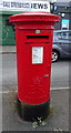
Elizabeth II postbox on Cross Lane, Bebington
Postbox No. CH63 498.
See Image] for context.
Image: © JThomas
Taken: 14 Sep 2019
0.22 miles