
IMAGES TAKEN NEAR TO
Blyth Road, WIRRAL, CH63 0HP
Introduction
This page details the photographs taken nearby to Blyth Road, CH63 0HP by members of the Geograph project.
The Geograph project started in 2005 with the aim of publishing, organising and preserving representative images for every square kilometre of Great Britain, Ireland and the Isle of Man.

There are currently over 7.5m images from over14,400 individuals and you can help contribute to the project by visiting https://www.geograph.org.uk
Image Map
Images are licensed for reuse under creativecommons.org/licenses/by-sa/2.0
Notes
- Clicking on the map will re-center to the selected point.
- The higher the marker number, the further away the image location is from the centre of the postcode.
Image Listing (22 Images Found)
Images are licensed for reuse under creativecommons.org/licenses/by-sa/2.0
Image
Details
Distance
1
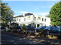
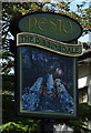
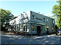
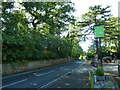
The Dibbinsdale Inn, Bromborough
On Dibbinsdale Road.
Image: © JThomas
Taken: 14 Sep 2019
0.05 miles
6
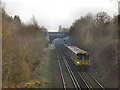
Bromborough
Merseyrail train approaching the bridge at the end of Acre Lane, after leaving Bromborough Station.
Image: © David Dixon
Taken: 3 Mar 2011
0.16 miles
7
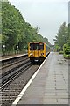
Arriving at Bromborough Railway Station
Multiple unit 508131 arrives with a service to Hooton and beyond, at the Chester-bound platform, during a rainy afternoon in June.
Image: © El Pollock
Taken: 8 Jun 2012
0.20 miles
8
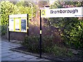
Bromborough Station
Bromborough Merseyrail Station on the Chester to Liverpool Line.
Image: © chestertouristcom
Taken: 13 Jan 2006
0.20 miles
9
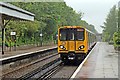
Arriving at Bromborough Railway Station
A wider view of multiple unit 508131 arriving with the service from Liverpool to Hooton.
Image: © El Pollock
Taken: 8 Jun 2012
0.21 miles
10
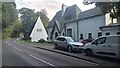
Dibbinsdale Road
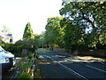
The two houses pictured only get given numbers on all the online maps. Considering how striking they both are I think it would be more fitting if they were given their proper names. Number 31 (the furthest away one) is 'Oak Tree House', and Number 33 is 'Dibbinsdale Cottage'. Oak Tree House doesn't look so impressive from this direction on account of the white panelling but from further up it is quite a sight - dark tiles going up and up to form a ridiculously steep high roof.
While the views from the road down here are great, the walk can be a little bit hairy, and the short stretch of narrow pavement in front of the car and van is fairly representative of the bitty pavement that leads to here heading North from the pub at the top of the hill. It is single file only at best and in other parts you would be lucky to find room to keep placing one foot on it while walking along.
The road may be even more of a lottery in the winter though, as it is apparently in the colder months that, a short distance further down at the small bridge crossing Dibbinsdale Brook, the 'Headless Lady of Dibbinsdale' sometimes appears, startling motorists in ghostly white. It is said that centuries back a nun and a monk were conducting a secret relationship; the nun became too overcome by guilt to go on and drowned herself in the water below.
Image: © Ian Dodds
Taken: 31 Aug 2024
0.22 miles