
IMAGES TAKEN NEAR TO
Ferry Road, WIRRAL, CH62 0DB
Introduction
This page details the photographs taken nearby to Ferry Road, CH62 0DB by members of the Geograph project.
The Geograph project started in 2005 with the aim of publishing, organising and preserving representative images for every square kilometre of Great Britain, Ireland and the Isle of Man.

There are currently over 7.5m images from over14,400 individuals and you can help contribute to the project by visiting https://www.geograph.org.uk
Image Map
Images are licensed for reuse under creativecommons.org/licenses/by-sa/2.0
Notes
- Clicking on the map will re-center to the selected point.
- The higher the marker number, the further away the image location is from the centre of the postcode.
Image Listing (66 Images Found)
Images are licensed for reuse under creativecommons.org/licenses/by-sa/2.0
Image
Details
Distance
1
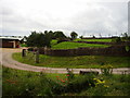
Mayfields Remembrance Park, Eastham
This park is one of just a handful of woodland burial sites in the region, with relatives given the option of planting a tree or shrub in memory of loved ones rather than the traditional headstone.
Image: © Eirian Evans
Taken: 14 Aug 2011
0.03 miles
2
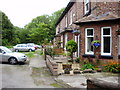
Terrace of Cottages on Lock Road, Eastham
Image: © Eirian Evans
Taken: 14 Aug 2011
0.06 miles
3
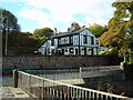
The Tap (Pier Bar), Eastham Ferry
Standing next to the River Mersey, and surrounded by woodland.
Image: © Ruth Harris
Taken: 3 Nov 2002
0.06 miles
4
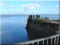
Eastham Ferry jetty
This is all that's left of the Eastham Ferry, the jetty jutting out into the Mersey estuary.
Image: © Ruth Harris
Taken: 3 Nov 2002
0.06 miles
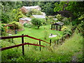
6
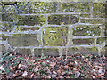
Bench mark alongside Ferry Road, Eastham
This bench mark is on the roadside wall, 137 metres south of the road to Eastham Locks. See also Image]
Image: © John S Turner
Taken: 1 Mar 2010
0.09 miles
7
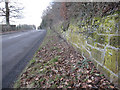
Ferry Road, Eastham and a bench mark
Looking south along Ferry Road from a point 137 metres south of the Eastham Locks road. There is a bench mark on the wall on the right. Behind the wall, Eastham Woods are part of the country park.
Image: © John S Turner
Taken: 1 Mar 2010
0.09 miles
8
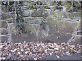
Bench mark opposite Lock Road, Eastham
This bench mark is on the west side of Eastham Road, a few metres north of Lock Road opposite. The mark was first recorded on the 1894 O.S. map. See also Image]
Image: © John S Turner
Taken: 1 Mar 2010
0.10 miles
9
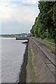
Riverside, Eastham
Looking along the river wall of the Mersey Estuary, from the jetty, towards Eastham Locks.
Image: © El Pollock
Taken: 10 Jul 2015
0.11 miles
10
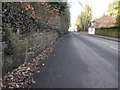
Ferry Road, Eastham and a bench mark
Looking north along Ferry Road nearly opposite Lock Road. There is a bench mark on the large stone in the wall on the left - Image
Image: © John S Turner
Taken: 1 Mar 2010
0.11 miles