IMAGES TAKEN NEAR TO
Farfield Avenue, DEESIDE, CH5 4SL
Introduction
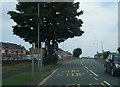
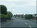
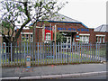
This page details the photographs taken nearby to Farfield Avenue, CH5 4SL by members of the Geograph project.
The Geograph project started in 2005 with the aim of publishing, organising and preserving representative images for every square kilometre of Great Britain, Ireland and the Isle of Man.

There are currently over 7.5m images from over14,400 individuals and you can help contribute to the project by visiting https://www.geograph.org.uk
Image Map
Images are licensed for reuse under creativecommons.org/licenses/by-sa/2.0
Notes
- Clicking on the map will re-center to the selected point.
- The higher the marker number, the further away the image location is from the centre of the postcode.
Image Listing (4 Images Found)
Images are licensed for reuse under creativecommons.org/licenses/by-sa/2.0
Image
Details
Distance
3
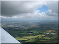
Aerial view of Connahs Quay River Dee
On flight from Isle of Islay to Wolverhampton. Passing by Connahs Quay in the west at 1400 ft.
Image: © Ulrich McCowan MacDonald
Taken: 7 Jul 2008
0.23 miles