IMAGES TAKEN NEAR TO
Fisherman's Road, DEESIDE, CH5 4EZ
Introduction
This page details the photographs taken nearby to Fisherman's Road, CH5 4EZ by members of the Geograph project.
The Geograph project started in 2005 with the aim of publishing, organising and preserving representative images for every square kilometre of Great Britain, Ireland and the Isle of Man.

There are currently over 7.5m images from over14,400 individuals and you can help contribute to the project by visiting https://www.geograph.org.uk
Image Map
Images are licensed for reuse under creativecommons.org/licenses/by-sa/2.0
Notes
- Clicking on the map will re-center to the selected point.
- The higher the marker number, the further away the image location is from the centre of the postcode.
Image Listing (77 Images Found)
Images are licensed for reuse under creativecommons.org/licenses/by-sa/2.0
Image
Details
Distance
1
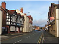
High Street, Connah's Quay
Looking across High Street, Connah's Quay towards The Ship public house. On the right is Zari, an Indian Restaurant.
Image: © John S Turner
Taken: 1 Feb 2016
0.03 miles
2
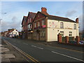
Zari Indian Restaurant, High Street, Connah's Quay
Looking across High Street, Connah's Quay towards the Zari Indian Restaurant. The building is dated '1929', and was once the Urban District Council Offices. There is an Ordnance Survey bench mark on the nearest corner of the stonework -
see Image
Image: © John S Turner
Taken: 1 Feb 2016
0.03 miles
4
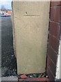
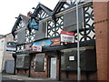
Bench mark on Zari Indian Restaurant
This bench mark is on the corner of what is now the Zari Indian Restaurant in High Street, Connah's Quay. The building dates to 1929 and was once the Urban District Council Offices. See also Image
Image: © John S Turner
Taken: 1 Feb 2016
0.04 miles
6

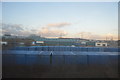
Railside industrial units with the Shotton Steelworks in the background
Image: © Eric Jones
Taken: 18 Sep 2008
0.09 miles
8
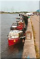
Connah's Quay wharf
The old wharf on the River Dee at Connah's Quay, now used mainly by leisure craft.
Image: © Bob Jones
Taken: Unknown
0.09 miles
9

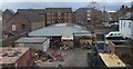
Industrial unit, Dock Road, Connah's Quay
Image: © David Smith
Taken: 6 May 2023
0.09 miles