
IMAGES TAKEN NEAR TO
Bethel Place, High Street, DEESIDE, CH5 4DW
Introduction
This page details the photographs taken nearby to Bethel Place, High Street, CH5 4DW by members of the Geograph project.
The Geograph project started in 2005 with the aim of publishing, organising and preserving representative images for every square kilometre of Great Britain, Ireland and the Isle of Man.

There are currently over 7.5m images from over14,400 individuals and you can help contribute to the project by visiting https://www.geograph.org.uk
Image Map
Images are licensed for reuse under creativecommons.org/licenses/by-sa/2.0
Notes
- Clicking on the map will re-center to the selected point.
- The higher the marker number, the further away the image location is from the centre of the postcode.
Image Listing (77 Images Found)
Images are licensed for reuse under creativecommons.org/licenses/by-sa/2.0
Image
Details
Distance
2
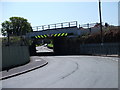
Bridge under the Chester to Holyhead Railway
A relatively new reinforced concrete bridge resting on the original stone abutments which provides road access to the many small industrial units around Connah's Quay Wharf.
Image: © John Haynes
Taken: 22 May 2012
0.05 miles
3

Cafe stop on Cycle Route 5
A portacabin on a small industrial site between the road and the railway does trade with passing delivery trucks, workers in the many industrial units, the cyclists on Route 5 and now walkers on the Welsh Coast Path.
Image: © John Haynes
Taken: 22 May 2012
0.05 miles
4
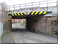
Dock Road railway bridge, Connahs Quay
Looking south under the Dock Road railway bridge, which carries the Chester to Holyhead railway line. There is an Ordnance Survey bench mark on the abutment on the right - Image
Image: © John S Turner
Taken: 11 Jan 2019
0.06 miles
6

Railside industrial units with the Shotton Steelworks in the background
Image: © Eric Jones
Taken: 18 Sep 2008
0.07 miles
7
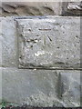
Bench mark on Dock Road railway bridge, Connahs Quay
This Ordnance Survey bench mark is on the north west abutment for the Dock Road railway bridge, Connahs Quay. See also Image
Image: © John S Turner
Taken: 11 Jan 2019
0.07 miles
8
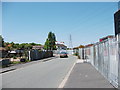
Llwybr Arfordir Cymru heads west
The many small industrial units and vacant sites around Doc Cei Connah provide a working backdrop for the Wales Coast Path which is heading towards the Old Quay House above the car. Image]
Image: © John Haynes
Taken: 22 May 2012
0.08 miles
9
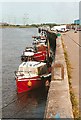
Connah's Quay wharf
The old wharf on the River Dee at Connah's Quay, now used mainly by leisure craft.
Image: © Bob Jones
Taken: Unknown
0.08 miles
10

Riverside Buildings
Business units on Docks Road.
Image: © Eirian Evans
Taken: 3 Feb 2012
0.08 miles