
IMAGES TAKEN NEAR TO
Cambrian Way, DEESIDE, CH5 3RE
Introduction
This page details the photographs taken nearby to Cambrian Way, CH5 3RE by members of the Geograph project.
The Geograph project started in 2005 with the aim of publishing, organising and preserving representative images for every square kilometre of Great Britain, Ireland and the Isle of Man.

There are currently over 7.5m images from over14,400 individuals and you can help contribute to the project by visiting https://www.geograph.org.uk
Image Map
Images are licensed for reuse under creativecommons.org/licenses/by-sa/2.0
Notes
- Clicking on the map will re-center to the selected point.
- The higher the marker number, the further away the image location is from the centre of the postcode.
Image Listing (9 Images Found)
Images are licensed for reuse under creativecommons.org/licenses/by-sa/2.0
Image
Details
Distance

4
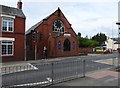
Highway Methodist Church
Methodist Church opposite the Co-op at Ewloe
Image: © Eirian Evans
Taken: 1 Jun 2015
0.18 miles
6
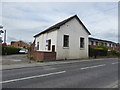
Primitive Methodist Chapel, Ewloe
This 1862 PM chapel became the church's schoolroom.There was a United Methodist chapel nearby in Hawarden, which has been demolished. The two congregations have amalgamated, and now worship in the current church in Ewloe, a few hundred yards along the road from the 1862 chapel in the photograph. This building has now been converted.
Image: © Eirian Evans
Taken: 1 Jun 2015
0.20 miles
7
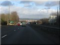
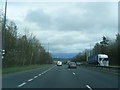
A494 descending from Ewloe
Although it now looks like a seamless part of the North Wales to M56 route, the section of dual carriageway between Ewloe and Shotwick traffic lights (A550/A5117 junction) dates back to the early 1960s. Until 1971 it was the only section of multi-lane road between Warrington and Abergele (where a bypass opened in 1968) via the A55 route. The Cheshire plain stretches out in the distance.
Image: © Peter Whatley
Taken: 18 Jan 2011
0.22 miles
8
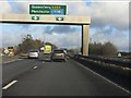
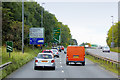
A494 at Ewloe flyover
Heading east from North Wales on the through route, the motorist finds that the A55 has seamlessly turned into the A494. Although Manchester is prominently signed, Birkenhead (for Liverpool) is not.
Image: © Peter Whatley
Taken: 18 Jan 2011
0.24 miles
9
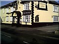
Crown & Liver Pub Ewloe
Crown & Liver Pub Ewloe
Image: © chestertouristcom
Taken: 12 Jan 2006
0.24 miles