
IMAGES TAKEN NEAR TO
Manor Lane, DEESIDE, CH5 3PP
Introduction
This page details the photographs taken nearby to Manor Lane, CH5 3PP by members of the Geograph project.
The Geograph project started in 2005 with the aim of publishing, organising and preserving representative images for every square kilometre of Great Britain, Ireland and the Isle of Man.

There are currently over 7.5m images from over14,400 individuals and you can help contribute to the project by visiting https://www.geograph.org.uk
Image Map
Images are licensed for reuse under creativecommons.org/licenses/by-sa/2.0
Notes
- Clicking on the map will re-center to the selected point.
- The higher the marker number, the further away the image location is from the centre of the postcode.
Image Listing (5 Images Found)
Images are licensed for reuse under creativecommons.org/licenses/by-sa/2.0
Image
Details
Distance
1
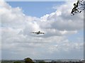
Broughton Aircraft Factory
This was taken when the Airbus A380 made a fly past over the factory on the 18th of May 2006
Image: © Ian Hargreaves
Taken: 18 May 2006
0.12 miles
2
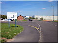
Aerospace Park, Broughton
The Aerospace Park near the Airbus Factory in Broughton.
Image: © Jeff Buck
Taken: 4 May 2016
0.16 miles
3
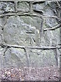
Bench mark on Broughton Brook Bridge
This bench mark is on the roadside wall above, and on the north west side of, Broughton Brook. A first Geodetic Levelling bench mark from 1851-52 is recorded close to this position, but on the south east side of the brook. Also the recorded height is different by about 0.5 metres so, if it is the same mark, I think the road has been raised and the wall has been rebuilt.
Image: © John S Turner
Taken: 8 Sep 2009
0.22 miles
4
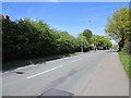
Manor Lane, Broughton
Manor Lane heading north-east near Hawarden Industrial Estate at Broughton.
Image: © Jeff Buck
Taken: 4 May 2016
0.23 miles
5
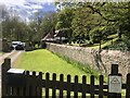
Broughton Lodge
Lodge to the Gladstone Estate near Broughton
Image: © Eirian Evans
Taken: 6 May 2021
0.25 miles