
IMAGES TAKEN NEAR TO
Glynne Way, DEESIDE, CH5 3NL
Introduction
This page details the photographs taken nearby to Glynne Way, CH5 3NL by members of the Geograph project.
The Geograph project started in 2005 with the aim of publishing, organising and preserving representative images for every square kilometre of Great Britain, Ireland and the Isle of Man.

There are currently over 7.5m images from over14,400 individuals and you can help contribute to the project by visiting https://www.geograph.org.uk
Image Map
Images are licensed for reuse under creativecommons.org/licenses/by-sa/2.0
Notes
- Clicking on the map will re-center to the selected point.
- The higher the marker number, the further away the image location is from the centre of the postcode.
Image Listing (227 Images Found)
Images are licensed for reuse under creativecommons.org/licenses/by-sa/2.0
Image
Details
Distance
1
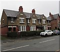
Stags Head Cottages, Hawarden
The cottages on the south side of the B5125 Glynne Way are dated 1910.
Image: © Jaggery
Taken: 6 Feb 2018
0.00 miles
2
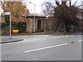
House of Correction, Hawarden
This ancient 'Lock up' stands at the top of Crosstree Lane where it joins Glynne Way, the main road through Hawarden Village. The weathered stone lintel above the door states 'House of Correction'. I believe the small stone structure just to the right of the tree may have been a water fountain.
Image: © John S Turner
Taken: 15 Nov 2006
0.00 miles
3
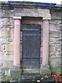
House of Correction, Hawarden
Door detail with 'House of Correction' lintel. Image
Image: © John S Turner
Taken: 15 Nov 2006
0.00 miles
4
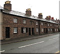
Grade II listed row of eight cottages, Glynne Way, Hawarden
The early 19th century cottages are near many other Listed buildings in Glynne Way.
Image: © Jaggery
Taken: 6 Feb 2018
0.01 miles
5
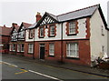
Edwardian building, Glynne Way, Hawarden
The year 1907 is on the large gable.
Image: © Jaggery
Taken: 6 Feb 2018
0.02 miles
6
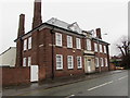
Distinctive brick building, Glynne Way, Hawarden
In February 2018, no name is in view to indicate the current use of this building on the corner of Crosstree Lane. Housing, offices or something else?
Image: © Jaggery
Taken: 6 Feb 2018
0.02 miles
7
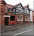
Black and white first floor, Glynne Way, Hawarden
On the left here. https://www.geograph.org.uk/photo/6587602
Image: © Jaggery
Taken: 6 Feb 2018
0.02 miles
8
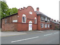
Hawarden Institute
The Hawarden Institute was founded by W.E. Gladstone in 1854 as a literary, scientific and technical institute for the "physical, social and intellectual benefit of all classes". The present building replaced the earlier one and was opened by Gladstone in 1893.
Image: © Eirian Evans
Taken: 1 Jun 2015
0.02 miles
9
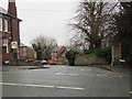
Down Crosstree Lane, Hawarden
Crosstree Lane descends from the north side of the B5125 Glynne Way.
Image: © Jaggery
Taken: 6 Feb 2018
0.03 miles
10
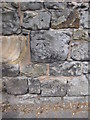
Bench mark in Glynne Way, Hawarden
This bench mark is on the substantial stone wall alongside Glynne Way, close to the stone water fountain and not far from the old lock-up.
Image: © John S Turner
Taken: 11 Jul 2009
0.03 miles