IMAGES TAKEN NEAR TO
Wood Lane, DEESIDE, CH5 3JE
Introduction
This page details the photographs taken nearby to Wood Lane, CH5 3JE by members of the Geograph project.
The Geograph project started in 2005 with the aim of publishing, organising and preserving representative images for every square kilometre of Great Britain, Ireland and the Isle of Man.

There are currently over 7.5m images from over14,400 individuals and you can help contribute to the project by visiting https://www.geograph.org.uk
Image Map
Images are licensed for reuse under creativecommons.org/licenses/by-sa/2.0
Notes
- Clicking on the map will re-center to the selected point.
- The higher the marker number, the further away the image location is from the centre of the postcode.
Image Listing (10 Images Found)
Images are licensed for reuse under creativecommons.org/licenses/by-sa/2.0
Image
Details
Distance
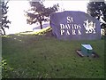
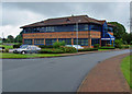
3
The Running Hare, St David's Business Park
Image: © Eirian Evans
Taken: 1 Jun 2015
0.18 miles
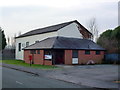
4
St Davids Business Park, Ewloe
St Davids Business Park, Ewloe
Image: © chestertouristcom
Taken: 12 Jan 2006
0.19 miles
5
Bala House, St David's Business Park, Ewloe
Image: © Peter Church
Taken: 24 Aug 2002
0.19 miles
6
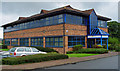
Bala House, St David's Business Park
Ewloe, west of Chester.
Image: © Peter Church
Taken: 24 Aug 2002
0.20 miles
7
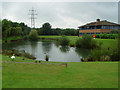
The Lake, St David's Business Park, Ewloe
Image: © Peter Church
Taken: 24 Aug 2002
0.23 miles
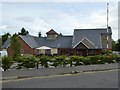
8
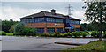
E.M.E., St David's Business Park, Ewloe
E.M.E. is Edison Mission Energy.
Image: © Peter Church
Taken: 24 Aug 2002
0.24 miles
9
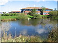
Ornamental pond at St Davids Business Park
A view looking north across the pond at the St. Davids Business Park.
Image: © Phil Williams
Taken: 26 Sep 2006
0.25 miles
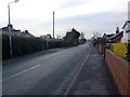
10
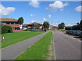
St. Davids Park
A view looking northeast along St. Davids Park. The building with the tower in the distance is a Church of Jesus Christ of Latter Day Saints and is not shown as such on the OS map.
Image: © Phil Williams
Taken: 26 Sep 2006
0.25 miles