IMAGES TAKEN NEAR TO
Holly Tree Close, DEESIDE, CH5 3AQ
Introduction
This page details the photographs taken nearby to Holly Tree Close, CH5 3AQ by members of the Geograph project.
The Geograph project started in 2005 with the aim of publishing, organising and preserving representative images for every square kilometre of Great Britain, Ireland and the Isle of Man.

There are currently over 7.5m images from over14,400 individuals and you can help contribute to the project by visiting https://www.geograph.org.uk
Image Map
Images are licensed for reuse under creativecommons.org/licenses/by-sa/2.0
Notes
- Clicking on the map will re-center to the selected point.
- The higher the marker number, the further away the image location is from the centre of the postcode.
Image Listing (24 Images Found)
Images are licensed for reuse under creativecommons.org/licenses/by-sa/2.0
Image
Details
Distance
1
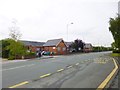
Ewloe Green, primary school
Ewloe Green C.P. School / Ysgol Ewloe Green, on Mold Road. http://www.ewloegreen.co.uk/aboutus.html
Image: © Mike Faherty
Taken: 17 May 2012
0.07 miles
3
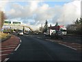
Getting ready for the Ewloe weave
Traffic eastbound off the A55 Chester bypass must make a route selection even before joining the A494 due to the closeness of the junctions (see http://www.geograph.org.uk/photo/2252259 for a longer explanation). The situation is not helped by peculiarities of route numbering locally which reflects the pre-1970s road system, rather than today's free-flow through route between A55 and M56.
Image: © Peter Whatley
Taken: 18 Jan 2011
0.09 miles
4
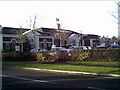
St Davids Park Hotel
St Davids Park Hotel
Image: © chestertouristcom
Taken: 12 Jan 2006
0.10 miles
5
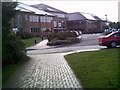
St Davids Business Park, Ewloe
St Davids Business Park, Ewloe
Image: © chestertouristcom
Taken: 12 Jan 2006
0.10 miles
6
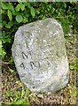
Old Milestone by the B5127, Ewloe Green, Hawarden Parish
By the B5127 (was A494), in parish of Hawarden (Flintshire District), Ewloe Green, between primary school and Old Liverpool Road on verge, South side of road.
Inscription reads:- : MOLD / 4 MILES : : QUEENSFERRY / 2 / MILES :
Surveyed
Milestone Society National ID: FLT_MDQF04
Image: © Milestone Society
Taken: Unknown
0.15 miles
7
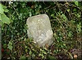
Old Milestone by the B5127, Ewloe Green, Hawarden Parish
By the B5127 (was A494), in parish of Hawarden (Flintshire District), Ewloe Green, between primary school and Old Liverpool Road on verge, South side of road.
Inscription reads:- : MOLD / 4 MILES : : QUEENSFERRY / 2 / MILES :
Surveyed
Milestone Society National ID: FLT_MDQF04
Image: © Christopher Leather
Taken: 27 Jul 2024
0.15 miles
8

E.M.E., St David's Business Park, Ewloe
E.M.E. is Edison Mission Energy.
Image: © Peter Church
Taken: 24 Aug 2002
0.18 miles
9
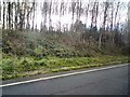
Trees by the A494
Roadside trees above the verge of the A494 on its approach to the A55.
Image: © Gerald England
Taken: 27 Nov 2015
0.18 miles