
IMAGES TAKEN NEAR TO
Woodland Street, DEESIDE, CH5 1HW
Introduction
This page details the photographs taken nearby to Woodland Street, CH5 1HW by members of the Geograph project.
The Geograph project started in 2005 with the aim of publishing, organising and preserving representative images for every square kilometre of Great Britain, Ireland and the Isle of Man.

There are currently over 7.5m images from over14,400 individuals and you can help contribute to the project by visiting https://www.geograph.org.uk
Image Map
Images are licensed for reuse under creativecommons.org/licenses/by-sa/2.0
Notes
- Clicking on the map will re-center to the selected point.
- The higher the marker number, the further away the image location is from the centre of the postcode.
Image Listing (91 Images Found)
Images are licensed for reuse under creativecommons.org/licenses/by-sa/2.0
Image
Details
Distance
1
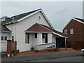
Christ Church, Shotton
On Victoria Road.
Image: © Eirian Evans
Taken: 11 Feb 2011
0.07 miles
2
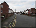
Victoria Road, Shotton
Towards the Beaconsfield Road junction on the left. The Rowden Street junction https://www.geograph.org.uk/photo/5689948 is on the right.
Image: © Jaggery
Taken: 22 Feb 2018
0.08 miles
3
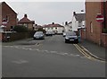
No Entry signs, Rowden Street, Shotton
Facing Victoria Road.
Image: © Jaggery
Taken: 22 Feb 2018
0.11 miles
4
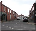
Rowden Street, Shotton
One-way street viewed across Chester Road West from the corner of Bridge Street.
Image: © Jaggery
Taken: 22 Feb 2018
0.12 miles
5
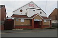
Crystal Bingo in Shotton
Bingo hall viewed across Victoria Road.
Image: © Jaggery
Taken: 22 Feb 2018
0.14 miles
6
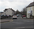
Brook Road, Shotton
On a bank of Wepre Brook which here marks the boundary between Shotton and Connah's Quay.
Image: © Jaggery
Taken: 22 Feb 2018
0.14 miles
7
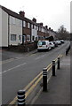
Brook Road, Shotton
On a bank of Wepre Brook which here marks the boundary between Shotton and Connah's Quay.
Viewed from the corner of the B5129 Chester Road West.
Image: © Jaggery
Taken: 22 Feb 2018
0.14 miles
8
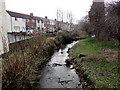
Rubbish dumped in Wepre Brook, Shotton
Looking downstream from Wepre Bridge. Wepre Brook is a tributary of the River Dee.
Brook Road is on the left.
Image: © Jaggery
Taken: 22 Feb 2018
0.15 miles
10
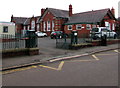
Ysgol Croes Atti, Shotton
Welsh medium primary school viewed across Plymouth Street, Shotton.
This school is a satellite of Ysgol Croes Atti in Flint. https://www.geograph.org.uk/photo/5256901
Image: © Jaggery
Taken: 22 Feb 2018
0.16 miles