IMAGES TAKEN NEAR TO
Chester Close, DEESIDE, CH5 1AX
Introduction
This page details the photographs taken nearby to Chester Close, CH5 1AX by members of the Geograph project.
The Geograph project started in 2005 with the aim of publishing, organising and preserving representative images for every square kilometre of Great Britain, Ireland and the Isle of Man.

There are currently over 7.5m images from over14,400 individuals and you can help contribute to the project by visiting https://www.geograph.org.uk
Image Map
Images are licensed for reuse under creativecommons.org/licenses/by-sa/2.0
Notes
- Clicking on the map will re-center to the selected point.
- The higher the marker number, the further away the image location is from the centre of the postcode.
Image Listing (108 Images Found)
Images are licensed for reuse under creativecommons.org/licenses/by-sa/2.0
Image
Details
Distance
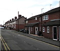
1
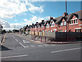
Shotton
Shotton township expanded rapidly with the establishment of John Summers steel works on Dee marshes.
Image: © Dennis Turner
Taken: 25 Sep 2005
0.08 miles
2
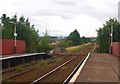
Rheilffordd Wrecsam - Bidston / Wrexham - Bidston Railway
This image, taken from Shotton Upper Level Station, shows the railway track along an incline towards Hawarden.
Image: © Ceri Thomas
Taken: 14 Aug 2009
0.10 miles
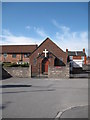
3
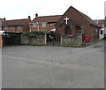
Bethel Baptist Church, Shotton
At the southern end of Wellington Street.
Image: © Jaggery
Taken: 22 Feb 2018
0.13 miles
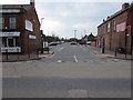
4
Wellington Street, Shotton
From Chester Road East along Wellington Street towards Bethel Baptist Church. https://www.geograph.org.uk/photo/5688733
Image: © Jaggery
Taken: 22 Feb 2018
0.14 miles
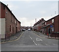
5
Wellington Street, Shotton
Dead-end street viewed from the corner of Chester Road East.
Image: © Jaggery
Taken: 22 Feb 2018
0.14 miles
7
Charmleys Lane Car Park in Shotton town centre
Free to use in February 2018, the Flintshire County Council
car park is on the south side of the B5129 Chester Road West.
Image: © Jaggery
Taken: 22 Feb 2018
0.17 miles
8
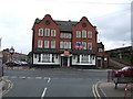
Central Hotel, Shotton
Former station hotel adjacent to Shotton High Level station, former Great Central Railway.
Image: © al partington
Taken: 17 May 2006
0.17 miles
9
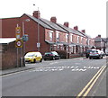
King George Street houses, Shotton
The 30mph speed limit drops to 20mph on the approach to a primary school. Speed bumps are ahead.
Image: © Jaggery
Taken: 22 Feb 2018
0.18 miles
10
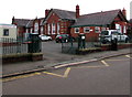
Ysgol Croes Atti, Shotton
Welsh medium primary school viewed across Plymouth Street, Shotton.
This school is a satellite of Ysgol Croes Atti in Flint. https://www.geograph.org.uk/photo/5256901
Image: © Jaggery
Taken: 22 Feb 2018
0.18 miles