
IMAGES TAKEN NEAR TO
Cannon Way, CHESTER, CH4 9PG
Introduction
This page details the photographs taken nearby to Cannon Way, CH4 9PG by members of the Geograph project.
The Geograph project started in 2005 with the aim of publishing, organising and preserving representative images for every square kilometre of Great Britain, Ireland and the Isle of Man.

There are currently over 7.5m images from over14,400 individuals and you can help contribute to the project by visiting https://www.geograph.org.uk
Image Map
Images are licensed for reuse under creativecommons.org/licenses/by-sa/2.0
Notes
- Clicking on the map will re-center to the selected point.
- The higher the marker number, the further away the image location is from the centre of the postcode.
Image Listing (25 Images Found)
Images are licensed for reuse under creativecommons.org/licenses/by-sa/2.0
Image
Details
Distance
1
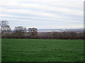
Looking towards Broughton
The large white expanse in the distance is the Airbus Factory where they manufacture the wings for all Airbus' aircraft including the A320, A330, A340, A350 and the A380 superjumbo.
Image: © Eirian Evans
Taken: 15 Jan 2019
0.08 miles
2
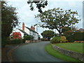
Bennets Lane, Higher Kinnerton
Approaching village from east south-east.
Image: © Michael Campbell
Taken: 18 Oct 2007
0.09 miles
3
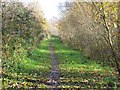
Footpath at Higher Kinnerton
This short local footpath runs along the trackbed of the disused railway, which used to run from Mold Junction, Saltney, to Mold. Just behind the camera is the railway bridge Image
Image: © John S Turner
Taken: 26 Nov 2006
0.10 miles
4
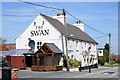
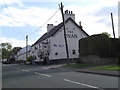
The Swan Country Pub & Restaurant
The Swan on Main Road, Higher Kinnerton.
Image: © Jeff Buck
Taken: 2 May 2013
0.10 miles
6
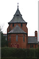
All Saints Parish Church
Higher Kinnerton
Image: © David Long
Taken: 7 Mar 2006
0.11 miles
7
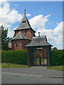
All Saints Church, Higher Kinnerton
Higher Kinnerton is in the south-east of Flintshire, bordering Chester and Wrexham. All Saints Church is a red-brick building, built in 1893, is in the parish of Dodleston, which is in England.
Image: © Eirian Evans
Taken: 4 Jun 2008
0.11 miles
8
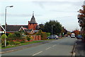
Main Road, Higher Kinnerton
Looking North towards village centre. All Saints Church Prominent mid-picture.
Image: © Michael Campbell
Taken: 18 Oct 2007
0.12 miles
9
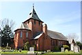
All Saints Church, Higher Kinnerton
All Saints church was designed by Douglas & Fordham and built in 1893.
Wikipedia http://en.wikipedia.org/wiki/All_Saints_Church,_Higher_Kinnerton
Image: © Jeff Buck
Taken: 2 May 2013
0.12 miles
10
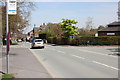
Main Road, Higher Kinnerton
On the right is Higher Kinnerton village hall on the junction with Bennetts Lane.
Image: © Jeff Buck
Taken: 2 May 2013
0.12 miles