IMAGES TAKEN NEAR TO
Church Road, CHESTER, CH4 9NG
Introduction
This page details the photographs taken nearby to Church Road, CH4 9NG by members of the Geograph project.
The Geograph project started in 2005 with the aim of publishing, organising and preserving representative images for every square kilometre of Great Britain, Ireland and the Isle of Man.

There are currently over 7.5m images from over14,400 individuals and you can help contribute to the project by visiting https://www.geograph.org.uk
Image Map
Images are licensed for reuse under creativecommons.org/licenses/by-sa/2.0
Notes
- Clicking on the map will re-center to the selected point.
- The higher the marker number, the further away the image location is from the centre of the postcode.
Image Listing (10 Images Found)
Images are licensed for reuse under creativecommons.org/licenses/by-sa/2.0
Image
Details
Distance
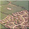
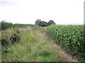
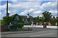
2
Lane to Dodleston
Lane connecting Church Road with Penfold Way.
Image: © Jeff Buck
Taken: 5 Mar 2013
0.11 miles
3
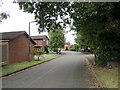
Penfold Way, Dodleston
Penfold Way, one of the roads in the new estate in Dodleston.
Image: © Jeff Buck
Taken: 21 Aug 2014
0.11 miles
4
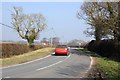
Church Road, Dodleston
Church Road heading out of Dodleston.
Image: © Jeff Buck
Taken: 5 Mar 2013
0.14 miles
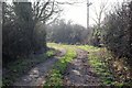
5
Footpath from Dodleston
This public footpath heads towards the Shrewsbury to Chester Line but is cut off at the A483 which, since becoming a four lane dual carriageway is now impossible to cross.
Image: © Jeff Buck
Taken: 21 Aug 2014
0.18 miles
6
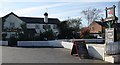
The Red Lion Pub, Dodleston
The pub recently received "Best Family Friendly Pub" at the 2007 Chester Food & Drink Festival.
Image: © Paul Roberts
Taken: 27 May 2007
0.21 miles
7
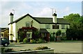
The Red Lion, Dodleston
A bit of history from the pub's website:
An 18th Century map suggests The Red Lion was established as far back as 1737, though then it was known as "The Red Lyon". Our quiet and peaceful history was interrupted in the autumn of 1845 when the inn became the scene of a battle between angry Irish and English farm labourers.
Image: © Jeff Buck
Taken: Unknown
0.22 miles
9
Red Lion Inn, Dodleston
Grade II listed inn on Church Road, Dodleston
Image: © Eirian Evans
Taken: 4 Jun 2008
0.22 miles
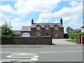
10
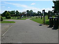
Dodleston Village Recreation Ground
Next to St Mary's Church, on Church Road.
Image: © Eirian Evans
Taken: 4 Jun 2008
0.24 miles