
IMAGES TAKEN NEAR TO
Croft Lane, CHESTER, CH4 9NF
Introduction
This page details the photographs taken nearby to Croft Lane, CH4 9NF by members of the Geograph project.
The Geograph project started in 2005 with the aim of publishing, organising and preserving representative images for every square kilometre of Great Britain, Ireland and the Isle of Man.

There are currently over 7.5m images from over14,400 individuals and you can help contribute to the project by visiting https://www.geograph.org.uk
Image Map
Images are licensed for reuse under creativecommons.org/licenses/by-sa/2.0
Notes
- Clicking on the map will re-center to the selected point.
- The higher the marker number, the further away the image location is from the centre of the postcode.
Image Listing (37 Images Found)
Images are licensed for reuse under creativecommons.org/licenses/by-sa/2.0
Image
Details
Distance
1
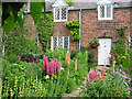
Cottage and garden, Dodleston
Typical Cheshire cottage built in 1863 for the Duke of Westminster's estate workers.
Image: © Devon Rex
Taken: 25 Jun 2005
0.03 miles
2
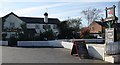
The Red Lion Pub, Dodleston
The pub recently received "Best Family Friendly Pub" at the 2007 Chester Food & Drink Festival.
Image: © Paul Roberts
Taken: 27 May 2007
0.10 miles
3

Year Stone on Dodleston Village Hall entrance
Built in 1896. The W stands for Duke of Westminster who lives in Eaton Hall nearby.
Image: © Paul Roberts
Taken: 29 Jul 2007
0.10 miles
4
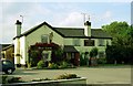
The Red Lion, Dodleston
A bit of history from the pub's website:
An 18th Century map suggests The Red Lion was established as far back as 1737, though then it was known as "The Red Lyon". Our quiet and peaceful history was interrupted in the autumn of 1845 when the inn became the scene of a battle between angry Irish and English farm labourers.
Image: © Jeff Buck
Taken: Unknown
0.11 miles
5
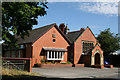
Dodleston Village Hall
The year stone above the entrance door indicates the hall was built in 1896. The extension on the left was added in 1990 and the year stone has the initials "DVF" which stands for Dodleston Village Foundation.
Image: © Paul Roberts
Taken: 1 Jan 1998
0.11 miles
6
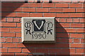
Year Stone on Dodleston Village Hall extension
DVF stands for Dodleston Village Foundation.
Image: © Paul Roberts
Taken: 29 Jul 2007
0.12 miles
7
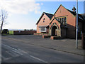
Dodleston Village Hall
Dodleston village hall was built in 1896 and is on the north side of Pulford Lane.
Image: © John S Turner
Taken: 6 Mar 2011
0.12 miles
8
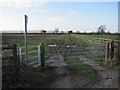
Footpath in Dodleston
This footpath heads off across the fields from Pulford Lane, Dodleston. According to my GPS I was standing just inside SJ36660, but most of the view is of SJ3560.
Image: © John S Turner
Taken: 6 Mar 2011
0.13 miles
9
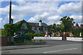
Red Lion Inn, Dodleston
Grade II listed inn on Church Road, Dodleston
Image: © Eirian Evans
Taken: 4 Jun 2008
0.13 miles
10
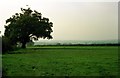
View towards the border from Dodleston
View across the fields towards the Welsh border from Pulford Lane, Dodleston.
Image: © Jeff Buck
Taken: Unknown
0.13 miles