IMAGES TAKEN NEAR TO
Dodleston Lane, CHESTER, CH4 9DS
Introduction
This page details the photographs taken nearby to Dodleston Lane, CH4 9DS by members of the Geograph project.
The Geograph project started in 2005 with the aim of publishing, organising and preserving representative images for every square kilometre of Great Britain, Ireland and the Isle of Man.

There are currently over 7.5m images from over14,400 individuals and you can help contribute to the project by visiting https://www.geograph.org.uk
Image Map
Images are licensed for reuse under creativecommons.org/licenses/by-sa/2.0
Notes
- Clicking on the map will re-center to the selected point.
- The higher the marker number, the further away the image location is from the centre of the postcode.
Image Listing (58 Images Found)
Images are licensed for reuse under creativecommons.org/licenses/by-sa/2.0
Image
Details
Distance
1
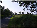
Approaching Pulford
Church spire merging with the trees on the road from Dodleston.
Image: © Michael Graham
Taken: 17 Jun 2006
0.01 miles
2
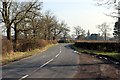
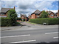
Dodleston Lane, Pulford
Dodleston Lane as it heads south east into Pulford. The spire of St Mary's Church can be seen in the distance.
Wikipedia http://en.wikipedia.org/wiki/Pulford
Image: © Jeff Buck
Taken: 18 Feb 2013
0.12 miles
3
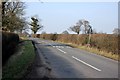
Dodleston Lane, Pulford
Dodleston Lane as it heads north west away from Pulford towards Dodleston.
Wikipedia http://en.wikipedia.org/wiki/Pulford
Image: © Jeff Buck
Taken: 18 Feb 2013
0.14 miles
4
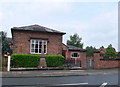
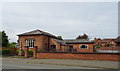
Village Hall and War Memorial, Pulford
Image: © Eirian Evans
Taken: 10 Jun 2009
0.18 miles
7
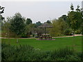
Garden of the Grosvenor Pulford Hotel
There are extensive landscaped gardens to this hotel, just beyond the England Wales border at Pulford.
Image: © Eirian Evans
Taken: 17 Sep 2008
0.19 miles
9
Castle Hill, Pulford
The name of this small development is no doubt taken from the Norman motte across the road behind the church.
Image: © John S Turner
Taken: 27 Aug 2009
0.19 miles
10

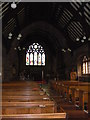
Ordnance Survey Cut Mark
This OS cut mark can be found on the west face of St Mary's church. It marks a point 15.149m above mean sea level.
Image: © Adrian Dust
Taken: 12 Jun 2016
0.20 miles