IMAGES TAKEN NEAR TO
Blantern Road, CHESTER, CH4 9DA
Introduction
This page details the photographs taken nearby to Blantern Road, CH4 9DA by members of the Geograph project.
The Geograph project started in 2005 with the aim of publishing, organising and preserving representative images for every square kilometre of Great Britain, Ireland and the Isle of Man.

There are currently over 7.5m images from over14,400 individuals and you can help contribute to the project by visiting https://www.geograph.org.uk
Image Map
Images are licensed for reuse under creativecommons.org/licenses/by-sa/2.0
Notes
- Clicking on the map will re-center to the selected point.
- The higher the marker number, the further away the image location is from the centre of the postcode.
Image Listing (19 Images Found)
Images are licensed for reuse under creativecommons.org/licenses/by-sa/2.0
Image
Details
Distance
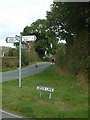
1
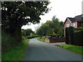
Sandy Lane, Higher Kinnerton
Looking southeast along Sandy Lane.
Image: © Michael Campbell
Taken: 18 Oct 2007
0.09 miles
3
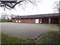
Scout Hall, Higher Kinnerton
The home of the 1st Kinnerton Scout Group
Image: © Eirian Evans
Taken: 15 Jan 2019
0.11 miles
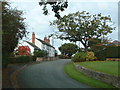
4
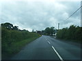
Main Road approaching Kinnerton Lane junction
Image: © Colin Pyle
Taken: 16 Jun 2012
0.15 miles
5
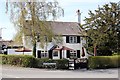
The Royal Oak, Higher Kinnerton
The Royal Oak on Kinnerton Lane, Higher Kinnerton.
Image: © Jeff Buck
Taken: 2 May 2013
0.15 miles
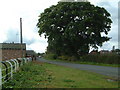
6
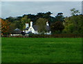
Royal Oak, Higher Kinnerton
From Sandy Lane, across field.
Image: © Michael Campbell
Taken: 18 Oct 2007
0.16 miles
7
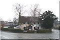
By birch and yew
No oak visible at this pub on the edge of Higher Kinnerton
Image: © David Long
Taken: 7 Mar 2006
0.17 miles
8
Higher Kinnerton
Green Lane, Sandy Lane, Bennets Lane junction.
Image: © Michael Campbell
Taken: 18 Oct 2007
0.20 miles
9
Bennets Lane, Higher Kinnerton
Approaching village from east south-east.
Image: © Michael Campbell
Taken: 18 Oct 2007
0.22 miles
10
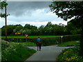
Green Lane, Higher Kinnerton
Village centre is straight ahead at junction (Bennets Lane),
Image: © Michael Campbell
Taken: 2 Jun 2002
0.22 miles