
IMAGES TAKEN NEAR TO
Meadow Crescent, WIRRAL, CH49 8HY
Introduction
This page details the photographs taken nearby to Meadow Crescent, CH49 8HY by members of the Geograph project.
The Geograph project started in 2005 with the aim of publishing, organising and preserving representative images for every square kilometre of Great Britain, Ireland and the Isle of Man.

There are currently over 7.5m images from over14,400 individuals and you can help contribute to the project by visiting https://www.geograph.org.uk
Image Map
Images are licensed for reuse under creativecommons.org/licenses/by-sa/2.0
Notes
- Clicking on the map will re-center to the selected point.
- The higher the marker number, the further away the image location is from the centre of the postcode.
Image Listing (8 Images Found)
Images are licensed for reuse under creativecommons.org/licenses/by-sa/2.0
Image
Details
Distance
1
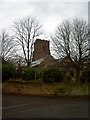
Holy Cross Church
One of only 2 buildings, the other the Church school, that were part of the original Woodchurch hamlet.
Image: © David Quinn
Taken: 22 Dec 2007
0.07 miles
2

Christ on the Cross at Holy Cross church, Woodchurch
This representation of Christ on the Cross is on the external north west face of the chancel of Holy Cross Church, Woodchurch, Wirral.
Image: © John S Turner
Taken: 30 Mar 2018
0.09 miles
3
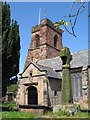
Holy Cross Church and Cross, Woodchurch
An ancient church, the nave originates from the 12th century but the circular style graveyard suggests a pre-Norman date. This early date is supported by the discovery of a portion of an Anglo-Saxon wheel cross at the grounds of the church in the late 19th or early 20th century and placed within the wall of the chancel within the church. The cross probably stood intact in the graveyard until the 17th century when many such crosses were destroyed by Puritans.
Image: © Sue Adair
Taken: 14 May 2012
0.10 miles
4
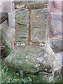
Bench mark on Holy Cross church, Woodchurch
This Ordnance Survey bench mark is on the south west buttress of Holy Cross church porch.
Image: © John S Turner
Taken: 30 Mar 2018
0.11 miles
5
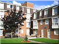
Wesley Grange
Sheltered Housing Scheme belonging to Wirral Methodist Housing Association Ltd.
Image: © Christine M Williams
Taken: 1 Sep 2004
0.11 miles
6
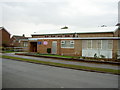
Woodchurch Community Centre Methodist Church
The church has helped fund the building of some residential blocks just to the right of the photograph.
Image: © David Quinn
Taken: 22 Dec 2007
0.13 miles
7
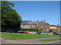
Old Schoolhouse, Woodchurch
Woodchurch Primary School dates back to 1665, making it one of the
oldest schools in Wirral. This schoolhouse was built in 1873 and the present adjacent school in 1954.
According to the school website:-
"William Gleave, of the city of London, died in the year 1665 and left to the Parish of Woodchurch £500 to erect a Free School. £400 was to be spent on the land, £100 for the building of a School House and £20 per annum for the maintenance of a Schoolmaster for ever! Attendance in 1873 is recorded as being poor due to “so many children being required by their parents to gather blackberries and mushrooms which the parents take to market”."
Image: © Sue Adair
Taken: 14 May 2012
0.15 miles
8
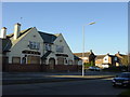
The Pelican, Woodchurch Estate
Boarded up, its upper windows smashed, the derelict public house "The Pelican" situated in Houghton Road, Woodchurch estate
Image: © Sue Adair
Taken: 13 Nov 2005
0.22 miles