IMAGES TAKEN NEAR TO
Woodland Road, WIRRAL, CH49 8HW
Introduction
This page details the photographs taken nearby to Woodland Road, CH49 8HW by members of the Geograph project.
The Geograph project started in 2005 with the aim of publishing, organising and preserving representative images for every square kilometre of Great Britain, Ireland and the Isle of Man.

There are currently over 7.5m images from over14,400 individuals and you can help contribute to the project by visiting https://www.geograph.org.uk
Image Map
Images are licensed for reuse under creativecommons.org/licenses/by-sa/2.0
Notes
- Clicking on the map will re-center to the selected point.
- The higher the marker number, the further away the image location is from the centre of the postcode.
Image Listing (15 Images Found)
Images are licensed for reuse under creativecommons.org/licenses/by-sa/2.0
Image
Details
Distance
3
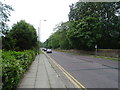
Arrowe Park Road
Looking south on the A551.
Image: © JThomas
Taken: 25 May 2019
0.13 miles
4
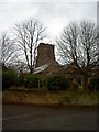
Holy Cross Church
One of only 2 buildings, the other the Church school, that were part of the original Woodchurch hamlet.
Image: © David Quinn
Taken: 22 Dec 2007
0.15 miles
5
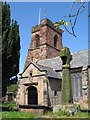
Holy Cross Church and Cross, Woodchurch
An ancient church, the nave originates from the 12th century but the circular style graveyard suggests a pre-Norman date. This early date is supported by the discovery of a portion of an Anglo-Saxon wheel cross at the grounds of the church in the late 19th or early 20th century and placed within the wall of the chancel within the church. The cross probably stood intact in the graveyard until the 17th century when many such crosses were destroyed by Puritans.
Image: © Sue Adair
Taken: 14 May 2012
0.15 miles
6

Christ on the Cross at Holy Cross church, Woodchurch
This representation of Christ on the Cross is on the external north west face of the chancel of Holy Cross Church, Woodchurch, Wirral.
Image: © John S Turner
Taken: 30 Mar 2018
0.15 miles
7
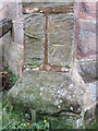
Bench mark on Holy Cross church, Woodchurch
This Ordnance Survey bench mark is on the south west buttress of Holy Cross church porch.
Image: © John S Turner
Taken: 30 Mar 2018
0.16 miles
9
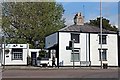
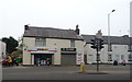
Former Toll House, Arrowe Park Road, Upton
Situated at the junction with Arrowe Brook Road.
Image: © El Pollock
Taken: 12 Jun 2012
0.16 miles