
IMAGES TAKEN NEAR TO
Warwick Road, WIRRAL, CH49 6NF
Introduction
This page details the photographs taken nearby to Warwick Road, CH49 6NF by members of the Geograph project.
The Geograph project started in 2005 with the aim of publishing, organising and preserving representative images for every square kilometre of Great Britain, Ireland and the Isle of Man.

There are currently over 7.5m images from over14,400 individuals and you can help contribute to the project by visiting https://www.geograph.org.uk
Image Map
Images are licensed for reuse under creativecommons.org/licenses/by-sa/2.0
Notes
- Clicking on the map will re-center to the selected point.
- The higher the marker number, the further away the image location is from the centre of the postcode.
Image Listing (11 Images Found)
Images are licensed for reuse under creativecommons.org/licenses/by-sa/2.0
Image
Details
Distance
1
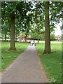
Overchurch Park, Upton
A small urban park located in Overchurch, a mainly residential area of Upton.
Image: © David Quinn
Taken: 26 May 2008
0.09 miles
3
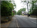
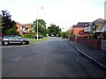
Moreton Road, Upton
Looking north west on the A551.
Image: © JThomas
Taken: 25 May 2019
0.14 miles
4
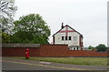
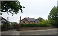
Patriot's house on Doncaster Drive, Upton
Showing position of Postbox No. CH49 315.
Image: © JThomas
Taken: 25 May 2019
0.14 miles
5
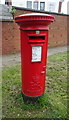
Elizabeth II postbox on Moreton Road, Upton
Postbox No. CH49 315.
Image: © JThomas
Taken: 25 May 2019
0.14 miles
8
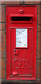
George V postbox on Moreton Road, Upton
Postbox No. CH49 442.
Image: © JThomas
Taken: 25 May 2019
0.18 miles
9
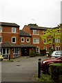
Liege House, Upton
Liege House is a private apartment block for people aged over 55, located just off Moreton Road in Upton Village. Manor House residential and nursing home stands behind this block and is visible from the motorway.
Image: © David Quinn
Taken: 26 May 2008
0.23 miles
10
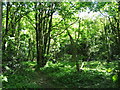
Overchurch Park Wood
Overchurch Park is the area of grass and woodland bordered by Royden Road, the Upton By-pass, Moreton Road and the Overchurch Estate, it includes Overchurch Graveyard and the site of a Norman Church, the earliest references to the church are in 1347 however in the mid 20th century odd shaped stones were discovered nearby which had strange inscriptions on them. After examination by an expert the strange stones were concluded to be ancient Saxon Runes. Dated to the 7th century this "bidding stone" is on display at the Grosvenor Museum in Chester.
In 1859 Thomas Webster built a house "Overchurch Hill" next to the old graveyard and Overchurch Park became part of the formal gardens and parkland of the house. In 1947 the house and land were sold and the house became a children's home and was demolished in the late 1950's. Gravestones can still be found scattered throughout the woodland.
Image: © Sue Adair
Taken: 14 May 2012
0.23 miles