IMAGES TAKEN NEAR TO
Arrowe Brook Lane, WIRRAL, CH49 3NY
Introduction
This page details the photographs taken nearby to Arrowe Brook Lane, CH49 3NY by members of the Geograph project.
The Geograph project started in 2005 with the aim of publishing, organising and preserving representative images for every square kilometre of Great Britain, Ireland and the Isle of Man.

There are currently over 7.5m images from over14,400 individuals and you can help contribute to the project by visiting https://www.geograph.org.uk
Image Map (Loading...)


Getting Data...Please wait
Leaflet Map data © OpenStreetMap
Images are licensed for reuse under creativecommons.org/licenses/by-sa/2.0
Notes
- Clicking on the map will re-center to the selected point.
- The higher the marker number, the further away the image location is from the centre of the postcode.
Image Listing (5 Images Found)
Images are licensed for reuse under creativecommons.org/licenses/by-sa/2.0
Image
Details
Distance
1
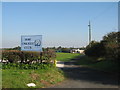
Irby Cricket Club
Irby Cricket Club, Mill Hill Road, founded in 1947, members of the Cheshire County League.
Image: © Sue Adair
Taken: 23 Oct 2007
0.21 miles
2
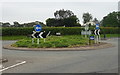
Roundabout near the Irby Mill Public House
Junction of Mill Lane and Arrowebrook Lane.
Image: © JThomas
Taken: 25 May 2019
0.24 miles
3
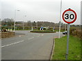
Irby Mill Roundabout.
A relatively busy roundabout where Arrowe Brook Lane, Mill Lane, Hillbark Road and Mill Hill Road meet. Irby Mill pub is just to the left of the photograph.
Image: © David Quinn
Taken: 15 Mar 2008
0.24 miles
4
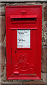
Edward VII postbox on Mill Hill
Postbox No. CH49 176.
Image: © JThomas
Taken: 25 May 2019
0.25 miles
5
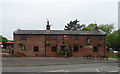
The Irby Mill Public House
At the junction of Mill Lane and Arrowebrook Lane.
Image: © JThomas
Taken: 25 May 2019
0.25 miles