
IMAGES TAKEN NEAR TO
Redford Close, WIRRAL, CH49 2QQ
Introduction
This page details the photographs taken nearby to Redford Close, CH49 2QQ by members of the Geograph project.
The Geograph project started in 2005 with the aim of publishing, organising and preserving representative images for every square kilometre of Great Britain, Ireland and the Isle of Man.

There are currently over 7.5m images from over14,400 individuals and you can help contribute to the project by visiting https://www.geograph.org.uk
Image Map
Images are licensed for reuse under creativecommons.org/licenses/by-sa/2.0
Notes
- Clicking on the map will re-center to the selected point.
- The higher the marker number, the further away the image location is from the centre of the postcode.
Image Listing (37 Images Found)
Images are licensed for reuse under creativecommons.org/licenses/by-sa/2.0
Image
Details
Distance
1
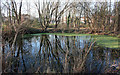
Across The Pond
View across drainage pond to Hambledon Drive.
Image: © J Scott
Taken: 13 Feb 2008
0.08 miles
2
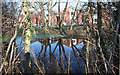
Pond Reflection
Reflection of houses in Stapleton Avenue in drainage pond.
Image: © J Scott
Taken: 13 Feb 2008
0.09 miles
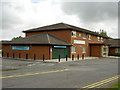
4
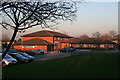
Health Centre
Greasby Health centre housing GPs and NHS Trust medical facilities. Chemist attached.
Image: © J Scott
Taken: 13 Feb 2008
0.15 miles
5
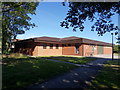
Greasby Library
Greasby Library and new extension. Greasby Village, Greasby Road.
Image: © J Scott
Taken: 3 Jul 2011
0.15 miles
6
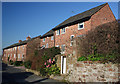
Looking North
Terraced cottages along Old Pump Lane between Greasby and Frankby Roads.
Image: © J Scott
Taken: 13 Feb 2008
0.16 miles
7
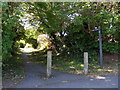
One A
Footpath between Frankby and Greasby Roads, to the rear of Red Cat public house, Greasby.
Image: © J Scott
Taken: 3 Jul 2011
0.16 miles
8
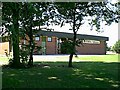
Greasby Library
Library adjacent Greasby Community Centre to extreme edge of the Village Green between Greasby Road and the B5139 (Frankby Road).
Image: © J Scott
Taken: 28 Jul 1999
0.16 miles
9
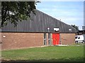
Greasby Community Centre
Community Centre adjacent the now demolished Doctors Surgery.
Image: © J Scott
Taken: 28 Jul 1999
0.16 miles
10
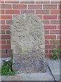
Old Milestone by Greasby library, south of the B5139
Carved stone post by the B5139, in parish of BIRKENHEAD (WIRRAL District), Frankby Road, Greasby, by public library, by brick wall. Erected by the Chester, Neston & Woodside Ferry turnpike trust in the 19th century.
Inscription reads:-
WOODSIDE
FERRY
6
Milestone Society National ID: CH_WSFB06.
Image: © J Haynes
Taken: 1 Sep 2012
0.16 miles