IMAGES TAKEN NEAR TO
Whiteside Close, WIRRAL, CH49 0XT
Introduction
This page details the photographs taken nearby to Whiteside Close, CH49 0XT by members of the Geograph project.
The Geograph project started in 2005 with the aim of publishing, organising and preserving representative images for every square kilometre of Great Britain, Ireland and the Isle of Man.

There are currently over 7.5m images from over14,400 individuals and you can help contribute to the project by visiting https://www.geograph.org.uk
Image Map
Images are licensed for reuse under creativecommons.org/licenses/by-sa/2.0
Notes
- Clicking on the map will re-center to the selected point.
- The higher the marker number, the further away the image location is from the centre of the postcode.
Image Listing (22 Images Found)
Images are licensed for reuse under creativecommons.org/licenses/by-sa/2.0
Image
Details
Distance
1
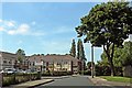
Care Home, Salacre Lane, Upton
Upton Grange Care Home was built in the last ten years, on the site of a former British Legion club. To the left-hand side is Shortfield Road.
Image: © El Pollock
Taken: 12 Jun 2012
0.09 miles
2
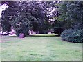
Salacre Common, Upton
Behind the sandstone wall on Salacre Lane. Formerly the front garden of, & driveway to, Salacre Farm. The road, in the picture, is Salacre Crescent.
Image: © El Pollock
Taken: 12 Jul 2009
0.10 miles
3
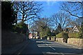
Ford Road, Upton
St. Mary's Church & Upton Village are just in view, up the road.
Image: © El Pollock
Taken: 1 Mar 2012
0.17 miles
4
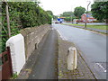
Rake Lane, Upton, Wirral
Looking south along Rake Lane towards its junction with Arrowe Park Road. There is an Ordnance Survey bench mark on the stone gatepost just beyond the white-painted wall - Image
Image: © John S Turner
Taken: 25 May 2018
0.18 miles
5
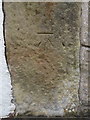
Bench mark near #21 Rake Lane, Upton, Wirral
This Ordnance Survey bench mark is on an old stone gatepost in front of #21 Rake lane, Upton. See also Image
Image: © John S Turner
Taken: 25 May 2018
0.18 miles
6
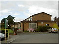
Upton Victory Hall
Upton Victory Hall is a local sports and community centre built in the 1920s to commemorate the fallen of WW1. This is the Salacre Lane building which houses the bowls, croquet, badminton, bridge, singing and other clubs. There is another building off Rake Lane which houses the tennis club.
Image: © David Quinn
Taken: 20 Jul 2008
0.19 miles
7
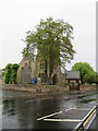
St Mary's church, Ford Road, Upton, Wirral
Looking towards St Mary's church across Ford Road, Upton on a very wet day. The church has an Ordnance Survey bench mark on the tower buttress immediately behind the large tree - Image
Image: © John S Turner
Taken: 25 May 2018
0.20 miles
8
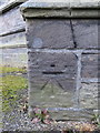
Bench mark on St Mary's church tower, Upton, Wirral
This Ordnance Survey bench mark is on the south west buttress of St Mary's church tower, Upton. See also Image
Image: © John S Turner
Taken: 25 May 2018
0.20 miles
9
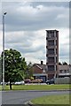
Fire Station Training Tower, Upton
Viewed from the roundabout on the A5027 Upton By-Pass.
Image: © El Pollock
Taken: 12 Jun 2012
0.21 miles