
IMAGES TAKEN NEAR TO
High Street, CHESTER, CH4 8SJ
Introduction
This page details the photographs taken nearby to High Street, CH4 8SJ by members of the Geograph project.
The Geograph project started in 2005 with the aim of publishing, organising and preserving representative images for every square kilometre of Great Britain, Ireland and the Isle of Man.

There are currently over 7.5m images from over14,400 individuals and you can help contribute to the project by visiting https://www.geograph.org.uk
Image Map
Images are licensed for reuse under creativecommons.org/licenses/by-sa/2.0
Notes
- Clicking on the map will re-center to the selected point.
- The higher the marker number, the further away the image location is from the centre of the postcode.
Image Listing (73 Images Found)
Images are licensed for reuse under creativecommons.org/licenses/by-sa/2.0
Image
Details
Distance
1
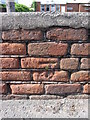
Weathered bench mark on Saltney High Street
This bench mark is on an old low wall in front of the more modern Saltney Social Club. The area was once terraced housing but that was all demolished around the 1960s. This wall is obviously associated with the old housing, but if the multi million pound Saltney Development plan ever goes ahead I would expect this wall to be swept away.
Image: © John S Turner
Taken: 20 Jul 2009
0.02 miles
3
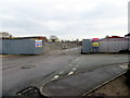
Saltney development site
This area behind High Street seems to be destined for a smart new housing development.
Image: © John S Turner
Taken: 18 Feb 2014
0.06 miles
4
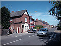
High Street Saltney
Main road through Saltney from Hawarden to Chester
Image: © Dennis Turner
Taken: 10 Aug 2005
0.06 miles
5
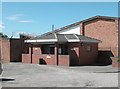
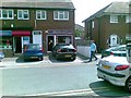
Saltney Toilet Facilities
Public conveniences in High Street Saltney.
Image: © Dennis Turner
Taken: 10 Aug 2005
0.07 miles
6
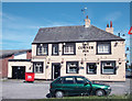
Corner Pin Saltney
Well known local landmark
Image: © Dennis Turner
Taken: 10 Aug 2005
0.07 miles
7
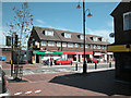
Saltney Shops
Just off Saltney High Street at the Corner Pin junction
Image: © Dennis Turner
Taken: 10 Aug 2005
0.07 miles
8
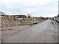
Saltney development site
This area behind High Street seems to be destined for a smart new housing development.
Image: © John S Turner
Taken: 18 Feb 2014
0.07 miles
9
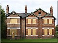
"Dalmeny" on High Street, Saltney
"Dalmeny" was built in the late nineteenth century for Charles Humphrey Deeley, who took over management of the Dee Oil Company from his father William Deeley. In 1901 it housed Charles, his wife Minnie, four children, a children's nurse, a cook and a housemaid. Originally a carriage way ran from the house over the railway line to the Oil Works. The house was extended in the early twentieth century [left hand wing]. It was bought in the 1920's and remained in the possession of that family until very recently. To the north & west the land is zoned for light industry - commercial; to the east and south is housing.
Image: © Natalia A McKenzie
Taken: 30 Sep 2006
0.08 miles
10
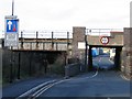
Bridge Street, Saltney
The aptly named Bridge Street passes under the main North Wales railway line and heads for the industrial River Lane. Balderton Brook flows under the iron bridge to the left of the road as it makes its way to join the River Dee.
Image: © John S Turner
Taken: 20 Nov 2006
0.08 miles