
IMAGES TAKEN NEAR TO
The Sidings, Boundary Lane, CHESTER, CH4 8RD
Introduction
This page details the photographs taken nearby to The Sidings, Boundary Lane, CH4 8RD by members of the Geograph project.
The Geograph project started in 2005 with the aim of publishing, organising and preserving representative images for every square kilometre of Great Britain, Ireland and the Isle of Man.

There are currently over 7.5m images from over14,400 individuals and you can help contribute to the project by visiting https://www.geograph.org.uk
Image Map
Images are licensed for reuse under creativecommons.org/licenses/by-sa/2.0
Notes
- Clicking on the map will re-center to the selected point.
- The higher the marker number, the further away the image location is from the centre of the postcode.
Image Listing (47 Images Found)
Images are licensed for reuse under creativecommons.org/licenses/by-sa/2.0
Image
Details
Distance
1
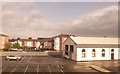
Great Western House and car park at Saltney
Image: © John Firth
Taken: 10 May 2014
0.02 miles
2

Chester City boundary stone by the Anchor Hotel, Saltney
This Chester City boundary stone stands against the side wall of the Anchor Hotel in Boundary Lane, Saltney. The inscription indicates that it was set up to commemorate the mayoralty of Henry B Dutton in 1913. The boundary follows Boundary Lane, the angled side wall of the hotel, then crosses High Street and follows the east side of the old River Lane to then cross the River Dee. The worn stump of sandstone to the left of the stone may be the remains of an even earlier boundary stone.
Inscription reads:
H B D
M
1913
Image: © John S Turner
Taken: 6 Jul 2009
0.03 miles
4
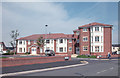
Saltney Apartments
Modern apartment block in Boundary Lane.
Image: © Dennis Turner
Taken: 18 Aug 2005
0.07 miles
5
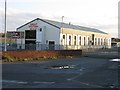
Great Western House
This historic locomotive shed, redundant but now modernised, shows what can be achieved with some thought rather than a bulldozer. It is shown on the 1882 Ordnance Survey map within a complex of railway sidings and other buildings, but it seems to be the only survivor from those times. It stands alongside Boundary Lane, which is more or less the boundary between England (where the building is) and Wales where the camera is. Boundary Lane meets the A5104 just to the left of the camera.
Image: © John S Turner
Taken: 20 Nov 2006
0.07 miles
6
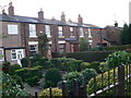
Saltney Houses
A neat row of terraced houses on the High Street in Saltney.
Image: © Eirian Evans
Taken: 7 Dec 2007
0.07 miles


9
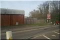
The leaving of Chester...
... and, of course, England.
Image: © David Long
Taken: 16 Mar 2009
0.08 miles
10

Chester City boundary stone by River Lane, Saltney
A fine new Chester City boundary stone has been installed in front of Asda, recognising the tenure of Lord Mayor Razia Daniels who was in post 2024/5. Unfortunately the stone has been installed on the east side of the modern day River Lane, whereas the joint city and England/Wales boundary runs along the east side of the old River Lane, which is about 15 metres further West, behind the camera.
Inscription reads:
LM
RD
2025
For a wider view see: Image
Image: © John S Turner
Taken: 19 Jul 2025
0.08 miles