
IMAGES TAKEN NEAR TO
Poppy Field Park, CHESTER, CH4 8FF
Introduction
This page details the photographs taken nearby to Poppy Field Park, CH4 8FF by members of the Geograph project.
The Geograph project started in 2005 with the aim of publishing, organising and preserving representative images for every square kilometre of Great Britain, Ireland and the Isle of Man.

There are currently over 7.5m images from over14,400 individuals and you can help contribute to the project by visiting https://www.geograph.org.uk
Image Map
Images are licensed for reuse under creativecommons.org/licenses/by-sa/2.0
Notes
- Clicking on the map will re-center to the selected point.
- The higher the marker number, the further away the image location is from the centre of the postcode.
Image Listing (58 Images Found)
Images are licensed for reuse under creativecommons.org/licenses/by-sa/2.0
Image
Details
Distance
1
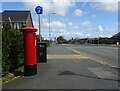
Chester Road (A5104), Saltney Ferry
Showing position of Postbox No. CH4 388.
See Image] for postbox.
Image: © JThomas
Taken: 19 Apr 2024
0.03 miles
2
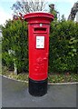
George V postbox on Chester Road, Saltney Ferry
Postbox No. CH4 388.
See Image] for context.
Image: © JThomas
Taken: 19 Apr 2024
0.03 miles
3
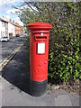
George V pillarbox by St David's Terrace
This pillarbox is on the corner of St David's Terrace and Chester Road.
Postbox number: CH4 388
Manufacturer: Carron Company Stirlingshire
Image: © John S Turner
Taken: 7 Apr 2009
0.03 miles
4
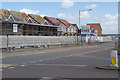
Chester Road, Saltney
Seen from the end of Sandy Lane, a new housing development by Edwards Homes is springing up on the north side of Chester Road. According to the builder's website: 'Situated in Saltney, just a short distance from the historic city of Chester, Mayfield Park comprises a stunning selection of 2, 3 and 4 bedroom semi-detached and detached homes'.
Image: © Stephen McKay
Taken: 14 Jun 2018
0.03 miles
5
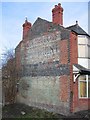
Faded advertising on house
The end wall of this house was a ready made advertising location as it faces all travellers towards Chester on the old main road from Broughton. From memory and careful scrutiny I believe it says:
BOLLANDS
RESTAURANT
Eastgate Street
CHESTER
[illegible]
Open on Sundays
[unclear]
Bollands used to be a licensed restaurant next to Browns of Chester.
Image: © John S Turner
Taken: 17 Feb 2007
0.04 miles
6
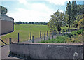
Saltney Community Centre Playing Fields
Image: © Dennis Turner
Taken: 15 Aug 2005
0.04 miles
7
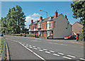
Chester Road
St David's Terrace on right of picture.
Image: © Dennis Turner
Taken: 15 Aug 2005
0.04 miles
8
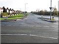
Sandy Lane, Saltney
Sandy Lane at its junction with the A5104 Chester Road. Sandy Lane is known locally as Ring Road because I understand it was built before the war (and brought to an end by the war) to be the first Chester bypass. In the distance this wide straight road turns sharp left into the much narrower Boundary Lane, which seems to confirm the story.
Image: © John S Turner
Taken: 27 Nov 2006
0.04 miles
9
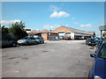
Saltney Bakery
Large commercial bakery which started as a small family bakery at Upton Mill. Image
Image: © Dennis Turner
Taken: 15 Aug 2005
0.05 miles
10
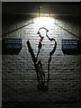
Lest We Forget - Saltney Community Centre
This outline soldier is on the wall of Saltney Community Centre at the junction of Chester Road and Sandy Lane. The inscriptions on the plaques are,
In Welsh:
fe roesant ein heddiw
er mwyn eich yfory chi
noddir Tomi Saltney gan eich
Canolfan Cymuned
In English:
for your tomorrow
we gave our today
the Saltney Tommy is sponsored by your
Community Centre
Image: © John S Turner
Taken: 7 Dec 2018
0.05 miles