
IMAGES TAKEN NEAR TO
Telford Way, CHESTER, CH4 8DA
Introduction
This page details the photographs taken nearby to Telford Way, CH4 8DA by members of the Geograph project.
The Geograph project started in 2005 with the aim of publishing, organising and preserving representative images for every square kilometre of Great Britain, Ireland and the Isle of Man.

There are currently over 7.5m images from over14,400 individuals and you can help contribute to the project by visiting https://www.geograph.org.uk
Image Map
Images are licensed for reuse under creativecommons.org/licenses/by-sa/2.0
Notes
- Clicking on the map will re-center to the selected point.
- The higher the marker number, the further away the image location is from the centre of the postcode.
Image Listing (42 Images Found)
Images are licensed for reuse under creativecommons.org/licenses/by-sa/2.0
Image
Details
Distance


4
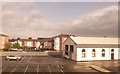
Great Western House and car park at Saltney
Image: © John Firth
Taken: 10 May 2014
0.07 miles
5
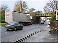
Bridge strike in Chester Road, Saltney
Unfortunately this RPC Containers truck was too tall for the railway bridge in Saltney.
Image: © John S Turner
Taken: 17 Nov 2006
0.09 miles
6

Another bridge strike in Chester Street, Saltney
Yet another over-height lorry has failed to make it under Saltney railway bridge.
Image: © John S Turner
Taken: 24 Jul 2018
0.09 miles
7

Chester City boundary stone by the Anchor Hotel, Saltney
This Chester City boundary stone stands against the side wall of the Anchor Hotel in Boundary Lane, Saltney. The inscription indicates that it was set up to commemorate the mayoralty of Henry B Dutton in 1913. The boundary follows Boundary Lane, the angled side wall of the hotel, then crosses High Street and follows the east side of the old River Lane to then cross the River Dee. The worn stump of sandstone to the left of the stone may be the remains of an even earlier boundary stone.
Inscription reads:
H B D
M
1913
Image: © John S Turner
Taken: 6 Jul 2009
0.09 miles
8
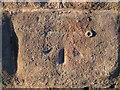
Bench mark on Saltney railway bridge
This early bench mark, dating to the First GL survey between 1840-1860, is on the north side of the A5104 where it passes under Saltney railway bridge. The mark is not recorded on the current Ordnance Survey database.
Image: © John S Turner
Taken: 12 Feb 2008
0.10 miles
9

Houses on Shrewsbury Way from a passing train
Image: © Colin Pyle
Taken: 16 Jul 2021
0.10 miles
10
The leaving of Chester...
... and, of course, England.
Image: © David Long
Taken: 16 Mar 2009
0.11 miles