
IMAGES TAKEN NEAR TO
Mount Pleasant, CHESTER, CH4 8BW
Introduction
This page details the photographs taken nearby to Mount Pleasant, CH4 8BW by members of the Geograph project.
The Geograph project started in 2005 with the aim of publishing, organising and preserving representative images for every square kilometre of Great Britain, Ireland and the Isle of Man.

There are currently over 7.5m images from over14,400 individuals and you can help contribute to the project by visiting https://www.geograph.org.uk
Image Map
Images are licensed for reuse under creativecommons.org/licenses/by-sa/2.0
Notes
- Clicking on the map will re-center to the selected point.
- The higher the marker number, the further away the image location is from the centre of the postcode.
Image Listing (42 Images Found)
Images are licensed for reuse under creativecommons.org/licenses/by-sa/2.0
Image
Details
Distance
1
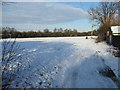
Saltney's snow-covered football field
This large open area is north of Chester Street and west of Mount Pleasant in Saltney. The hedge-line bordering the field to the left is the embankment for the railway line between Chester and Wrexham.
Image: © John S Turner
Taken: 22 Jan 2013
0.05 miles
2
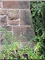
Bench mark on Saltney Christian Centre, Hough Green
This building was formerly the Methodist Church, Hough Green, but is now the Saltney Christian Centre. This clear bench mark is to the right of the front door and is usually hidden behind the plants.
Link added: https://www.bench-marks.org.uk/bm31205
Image: © John S Turner
Taken: 6 Jul 2009
0.08 miles
3
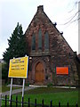
Saltney Christian Centre
On the corner of Hough Green and Glan Aber Drive in Saltney.
Image: © Eirian Evans
Taken: 7 Dec 2007
0.09 miles
5
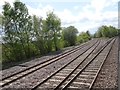
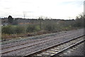
View from a Chester-Holyhead train - Saltney Junction
This is the junction for the line to Wrexham.
Image: © Nigel Thompson
Taken: 2 May 2018
0.10 miles
6
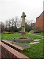
Saltney war memorial 11am 11-11-2011
This modest war memorial is in the churchyard of St Mark's, alongside St Mark's Road. It commemorates the men of Saltney who died in both World Wars although no names are recorded on the memorial. The inscriptions read:
1914-1919 1939-1945
IN ABIDING MEMORY OF THE MEN OF SALTNEY AND NEIGHBOURHOOD WHO GAVE THEIR LIVES IN THE GREAT WAR
LEST WE FORGET
THEIR NAME LIVETH FOR EVERMORE
LEST WE FORGET
THEY WERE A WALL UNTO US BOTH BY DAY AND NIGHT
Image: © John S Turner
Taken: 11 Nov 2011
0.11 miles
7
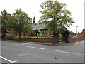
St Mark's church, Saltney
St Mark's was built in 1892 by T M Lockwood. The structure is Ruabon red brick and the roof is 'graded Westmorland slate'; it is Grade II listed. The perimeter wall is contemporaneous with the church but the Lych gate dates to 1920 and is separately listed Grade II. Analysis of the distances between marks on the surveyors schedule for the First Geodetic Levelling Chester to Flint section, seems to indicate that there was a bench mark at this location on a gate post on the south side of the road. However, the gatepost should be west of the brick works, which was actually west of it. Today the church is surrounded by housing.
Image: © John S Turner
Taken: 18 Sep 2009
0.11 miles
8
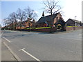
St Mark's church on Chester Road, Saltney
Image: © Raymond Knapman
Taken: 25 Mar 2015
0.11 miles
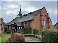
10
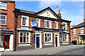
Brewery Arms
Public House in Chester.
Image: © Wayland Smith
Taken: 1 Sep 2012
0.11 miles