IMAGES TAKEN NEAR TO
Greenbank Road, WIRRAL, CH48 6DF
Introduction
This page details the photographs taken nearby to Greenbank Road, CH48 6DF by members of the Geograph project.
The Geograph project started in 2005 with the aim of publishing, organising and preserving representative images for every square kilometre of Great Britain, Ireland and the Isle of Man.

There are currently over 7.5m images from over14,400 individuals and you can help contribute to the project by visiting https://www.geograph.org.uk
Image Map
Images are licensed for reuse under creativecommons.org/licenses/by-sa/2.0
Notes
- Clicking on the map will re-center to the selected point.
- The higher the marker number, the further away the image location is from the centre of the postcode.
Image Listing (9 Images Found)
Images are licensed for reuse under creativecommons.org/licenses/by-sa/2.0
Image
Details
Distance
2

Apple Avenue
This apple avenue is an invitation to consider where our food comes from how we can reduce our food miles, encourage locally grown and support local independent shops.
and
When it’s ripe feel free to pick some fruit.
Image: © Ian Greig
Taken: 30 Jun 2017
0.13 miles
3
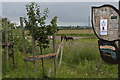
Apple trees and horses
The trees are still but loaded with fruit. Not yet ripe.
Image: © Ian Greig
Taken: 30 Jun 2017
0.15 miles
4
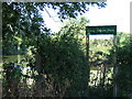
Gilroy Road Nature Reserve
Also known as Gilroy Nature Park (according to the sign). Picture taken from adjacent public footpath to Hoylake. Development of the park was very much an initiative of the local community.
Image: © Peter Miller
Taken: 29 Aug 2005
0.15 miles

6
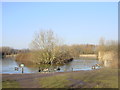
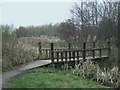
Pond, Gilroy Road Nature Reserve
Ducks and geese on the iced over pond at the Gilroy Road Nature Reserve.
Image: © Sue Adair
Taken: 29 Jan 2006
0.17 miles
7
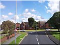
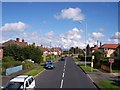
Greenbank Road joins Blackhorse Hill at West Kirby
Image: © Raymond Knapman
Taken: 30 Aug 2012
0.19 miles
8
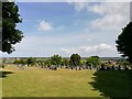
Grange Cemetery
Grange Cemetery between Lang Lane and Blackhorse Hill was opened after the First World War, the site was purchased in 1913.
Image: © Sue Adair
Taken: 3 Aug 2021
0.21 miles