
IMAGES TAKEN NEAR TO
Telegraph Road, WIRRAL, CH48 1PD
Introduction
This page details the photographs taken nearby to Telegraph Road, CH48 1PD by members of the Geograph project.
The Geograph project started in 2005 with the aim of publishing, organising and preserving representative images for every square kilometre of Great Britain, Ireland and the Isle of Man.

There are currently over 7.5m images from over14,400 individuals and you can help contribute to the project by visiting https://www.geograph.org.uk
Image Map
Images are licensed for reuse under creativecommons.org/licenses/by-sa/2.0
Notes
- Clicking on the map will re-center to the selected point.
- The higher the marker number, the further away the image location is from the centre of the postcode.
Image Listing (64 Images Found)
Images are licensed for reuse under creativecommons.org/licenses/by-sa/2.0
Image
Details
Distance
1
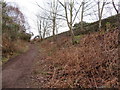
Footpath in Thurstaston Common and boundary stone #7
A footpath through Thurstaston Common alongside, and below Telegraph Road, which is behind the stone wall. Thurstaston Recreation Ground boundary stone #7 can be seen high up on the right - Image
Image: © John S Turner
Taken: 21 Jan 2019
0.05 miles
2
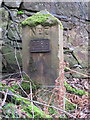
Thurstaston Recreation Ground Boundary Stone #7
Thurstaston Recreation Ground Boundary stone #7 stands high on a bank, between a footpath and the wall alongside Telegraph Road. Although the number 7 has a slightly unusual style, BS #6 is nearby, seemingly completing the sequence from #1 - #7, starting and finishing at Telegraph Road, and surrounding the woodland and rocky outcrop of Thurstaston Common. For a wider view of BS #7 see Image
Milestone Society National ID: CH_THUR07pb
Image: © John S Turner
Taken: 21 Jan 2019
0.05 miles
3
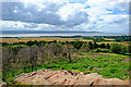
View towards Wales from Thurstaston Hill
Looking west across the Dee estuary towards Wales from Thurstaston Hill.
Image: © Jeff Buck
Taken: 18 Jul 2019
0.06 miles
4
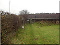
Footpath near Thurstaston.
The Footpath leads from Thurstaston to Caldy. The very busy Telegraph Road is just on the other side of the wall.
Image: © David Quinn
Taken: 22 Dec 2007
0.11 miles
5
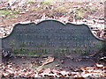
Smokers are requested
This cast iron sign lies next to the path, near to Thor's Stone on Thurstaston Common, it reads : Smokers are requested not to throw tobacco-ash or matches on the ground unless quite extinguished
Image: © BrianPritchard
Taken: 29 Nov 2017
0.12 miles
6

The view across the River Dee from the summit of Thurstaston Hill
Image: © Ian Greig
Taken: 22 Sep 2017
0.13 miles
7
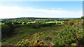
View towards Caldy Hill from Thurstaston Hill
Image: © Colin Park
Taken: 4 Jun 2021
0.14 miles
8
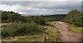
On Thurstaston Hill with a view of the mouth of the Dee Estuary
Image: © Ian Greig
Taken: 22 Sep 2017
0.14 miles
9
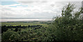
View from Thurstaston Hill
Looking towards the North Wales coast near Point of Ayr.
Image: © Dennis Turner
Taken: 20 May 2005
0.15 miles
10
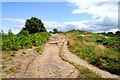
Path on Thurstaston Hill
Approaching the top of the hill.
Image: © Jeff Buck
Taken: 18 Jul 2019
0.15 miles