IMAGES TAKEN NEAR TO
Greenway Street, CHESTER, CH4 7JS
Introduction
This page details the photographs taken nearby to Greenway Street, CH4 7JS by members of the Geograph project.
The Geograph project started in 2005 with the aim of publishing, organising and preserving representative images for every square kilometre of Great Britain, Ireland and the Isle of Man.

There are currently over 7.5m images from over14,400 individuals and you can help contribute to the project by visiting https://www.geograph.org.uk
Image Map
Images are licensed for reuse under creativecommons.org/licenses/by-sa/2.0
Notes
- Clicking on the map will re-center to the selected point.
- The higher the marker number, the further away the image location is from the centre of the postcode.
Image Listing (897 Images Found)
Images are licensed for reuse under creativecommons.org/licenses/by-sa/2.0
Image
Details
Distance
1
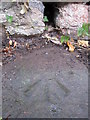
Rivet bench mark in Greenway Street, Handbridge
This cut mark and rivet are in the 'Living Rock' on the south side of Greenway Street, opposite Edgar Place. The mark is usually hidden behind a curtain of ivy, and the drain hole in the wall above regularly deposits a layer of sediment in an attempt to hide it further.
Image: © John S Turner
Taken: 8 Dec 2009
0.02 miles
2
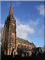
St. Mary's Church Without-the-Walls, Handbridge
St. Mary's Without-the-Walls in Handbridge, whose fine tall spire is clearly visible from all around. Built in 1877, occupying a site of a Roman cemetery, it was a gift to the city from the Duke of Westminster.
Image: © BrianPritchard
Taken: 30 Jan 2008
0.03 miles
3
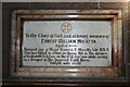
Marble Plaque.
This plaque in two different coloured marble, recalls the Siege of Ladysmith in South Africa and Ernest William Mocatta's part therein.
Image: © Geoff Evans
Taken: 11 Feb 2008
0.03 miles
4
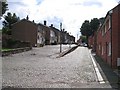
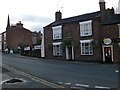
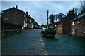
Greenway Street, Handbridge
Some years ago the old fishermen's cottages were replaced by these modern houses. The entrance to Edgar's Fields is just to the left Image, and the River Dee is behind the camera.
Image: © John S Turner
Taken: 16 Jul 2007
0.03 miles
5
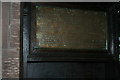
Bread Box
This brass plaque is inscribed in Latin, and is part of the " Bread Box " from an earlier church, about the 17th Century in date, and was always situated at or near the door of the Church, and bread was distributed from it to the poor of the Parish who had attended Church that morning.
Image: © Geoff Evans
Taken: 11 Feb 2008
0.03 miles
6
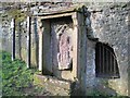
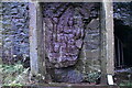
Minerva's shrine in Edgar's Field
This Roman shrine, dedicated to Minerva, is in Edgar's Field in Handbridge. It is extremely weathered and has suffered greatly over the last 2000 years. Despite the fact that it is the only monument of its type in Western Europe still in its original location it has no physical protection from the weather or from any other assault. It is thought that the small cave behind may have been used to place offerings. Chester City Council website has more information and an image of what the carving would have looked like originally: http://www.chester.gov.uk/tourism_and_leisure/heritage_trails/discover_edgars_field/minerva_shrine.aspx
Image: © John S Turner
Taken: 30 Mar 2008
0.04 miles
8
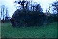
Minerva Shrine, Edgar's Field (rear view)
Image: © N Chadwick
Taken: 18 Dec 2019
0.04 miles