
IMAGES TAKEN NEAR TO
Lower Park Road, CHESTER, CH4 7BB
Introduction
This page details the photographs taken nearby to Lower Park Road, CH4 7BB by members of the Geograph project.
The Geograph project started in 2005 with the aim of publishing, organising and preserving representative images for every square kilometre of Great Britain, Ireland and the Isle of Man.

There are currently over 7.5m images from over14,400 individuals and you can help contribute to the project by visiting https://www.geograph.org.uk
Image Map
Images are licensed for reuse under creativecommons.org/licenses/by-sa/2.0
Notes
- Clicking on the map will re-center to the selected point.
- The higher the marker number, the further away the image location is from the centre of the postcode.
Image Listing (628 Images Found)
Images are licensed for reuse under creativecommons.org/licenses/by-sa/2.0
Image
Details
Distance
1
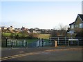
Earls Eye/The Meadows
Officially the Earls Eye (field), but generally known as the Meadows, this land was purchased by the city in 1929 with money donated by Alderman Brown. He wanted it to be an amenity for the people of Chester, which it still is today.
Image: © John S Turner
Taken: 4 Dec 2006
0.03 miles
2
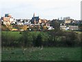
The Meadows and St Paul's, Boughton
Looking from Lower Park Road, Handbridge, across The Meadows and the River Dee to Boughton. St Paul's church, designed by the significant local architect John Douglas 1830-1911, is in the centre, and the top of the water tower can be seen at top left.
Image: © John S Turner
Taken: 4 Dec 2006
0.03 miles
3
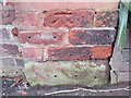
Bench mark in Lower Park Road, Handbridge
This weathered bench mark is on the wall outside #17 Lower Park Road, Handbridge. For details of the mark see: http://www.bench-marks.org.uk/bm46659
Image: © John S Turner
Taken: 26 Dec 2012
0.03 miles
4
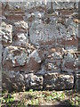
Bench mark by the River Dee
This bench mark is alongside the River Dee and the path to The Meadows. The north northwest-facing wall gets little sun under the surrounding trees and it seems to be covered with lichen. See also Image
Image: © John S Turner
Taken: 9 Jul 2009
0.03 miles
5
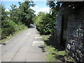
Riverside walk to The Meadows and a bench mark
Looking along the riverside walk that leads to the meadows. On the third course of stones on the sandstone wall on the right there is a bench mark - Image
Image: © John S Turner
Taken: 9 Jul 2009
0.04 miles
7
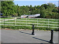
A view from Lower Park Road, Queen's Park
A view from the corner of Lower Park Road and Elizabeth Crescent. The rowing club headquarters is on the south bank of the River Dee and the pointed roof of Billy Hobby's Well can just be seen through the trees on the north side. The distant specimen trees are in the popular Grosvenor Park. The path to the right leads down to The Meadows - see also Image
Image: © John S Turner
Taken: 19 May 2008
0.06 miles
9
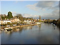
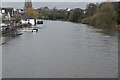
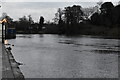
North Bank of the River Dee at Chester
North Bank of the River Dee from the suspension bridge.
Image: © Sue Adair
Taken: 4 Dec 2005
0.06 miles
10
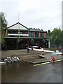
The King's School Rowing Club
Finishing up for the day.
Image: © David Anstiss
Taken: 3 Sep 2008
0.06 miles