IMAGES TAKEN NEAR TO
Bennets Lane, WIRRAL, CH47 7AZ
Introduction
This page details the photographs taken nearby to Bennets Lane, CH47 7AZ by members of the Geograph project.
The Geograph project started in 2005 with the aim of publishing, organising and preserving representative images for every square kilometre of Great Britain, Ireland and the Isle of Man.

There are currently over 7.5m images from over14,400 individuals and you can help contribute to the project by visiting https://www.geograph.org.uk
Image Map
Images are licensed for reuse under creativecommons.org/licenses/by-sa/2.0
Notes
- Clicking on the map will re-center to the selected point.
- The higher the marker number, the further away the image location is from the centre of the postcode.
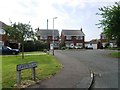
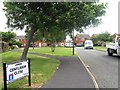
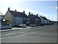
Image Listing (29 Images Found)
Images are licensed for reuse under creativecommons.org/licenses/by-sa/2.0
Image
Details
Distance

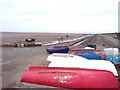
6
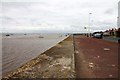
The Slipway at Meols
The slipway at Meols on the Wirral with the Wallasey Embankment in the distance.
Wikipedia https://en.wikipedia.org/wiki/Meols
Image: © Jeff Buck
Taken: 25 Jan 2017
0.15 miles
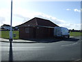
7
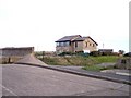
Coastguard station at Dove Point Meols
Image: © Raymond Knapman
Taken: 12 Nov 2008
0.15 miles
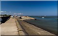
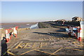
9
Slipway and sea defences at Dove Point Meols
Image: © Raymond Knapman
Taken: 12 Nov 2008
0.15 miles