
IMAGES TAKEN NEAR TO
Twickenham Drive, WIRRAL, CH46 1PG
Introduction
This page details the photographs taken nearby to Twickenham Drive, CH46 1PG by members of the Geograph project.
The Geograph project started in 2005 with the aim of publishing, organising and preserving representative images for every square kilometre of Great Britain, Ireland and the Isle of Man.

There are currently over 7.5m images from over14,400 individuals and you can help contribute to the project by visiting https://www.geograph.org.uk
Image Map
Images are licensed for reuse under creativecommons.org/licenses/by-sa/2.0
Notes
- Clicking on the map will re-center to the selected point.
- The higher the marker number, the further away the image location is from the centre of the postcode.
Image Listing (8 Images Found)
Images are licensed for reuse under creativecommons.org/licenses/by-sa/2.0
Image
Details
Distance
1
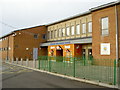
Leasowe Millennium Centre
A new community building with conference and wedding facilities, a cafe, a gym and community support services.
Image: © David Quinn
Taken: 5 Jan 2008
0.09 miles
2
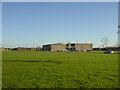
Leasowe Recreation Centre
Leasowe Recreation Centre and playing fields are situated in Twickenham Drive.
Image: © Sue Adair
Taken: 13 Nov 2005
0.14 miles
4
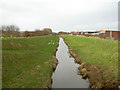
View of The Birket.
Looking upriver towards Reeds Lane.
Image: © David Quinn
Taken: 5 Jan 2008
0.20 miles
5
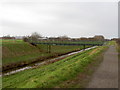
Footbridge over The Birket
Carries the footpath and an off-shoot of Route 56 over The Birket. The footpath links Mackensie Road with Reeds Lane and onwards to the North Wirral Coastal Country Park.
Image: © David Quinn
Taken: 5 Jan 2008
0.21 miles
6
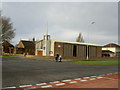
St. Chad's Church, Leasowe.
St. Chad’s Church is located on Castleway North and of the Church of England denomination.
Image: © David Quinn
Taken: 5 Jan 2008
0.23 miles
7
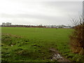
Playing Fields near Leasowe.
The local playing fields for the Leasowe estate. The buildings on the right are part of the Bristol-Myers-Squibb complex and the tower blocks on the left are in Moreton Image
Image: © David Quinn
Taken: 5 Jan 2008
0.24 miles
8
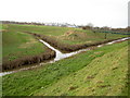
Confluence of The Birket and the River Fender.
Image: © David Quinn
Taken: 5 Jan 2008
0.25 miles