
IMAGES TAKEN NEAR TO
Barmouth Road, WALLASEY, CH45 8JB
Introduction
This page details the photographs taken nearby to Barmouth Road, CH45 8JB by members of the Geograph project.
The Geograph project started in 2005 with the aim of publishing, organising and preserving representative images for every square kilometre of Great Britain, Ireland and the Isle of Man.

There are currently over 7.5m images from over14,400 individuals and you can help contribute to the project by visiting https://www.geograph.org.uk
Image Map
Images are licensed for reuse under creativecommons.org/licenses/by-sa/2.0
Notes
- Clicking on the map will re-center to the selected point.
- The higher the marker number, the further away the image location is from the centre of the postcode.
Image Listing (56 Images Found)
Images are licensed for reuse under creativecommons.org/licenses/by-sa/2.0
Image
Details
Distance
1
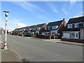
Green Lane, Wallasey
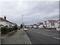
A residential street in Wallasey. A line of uniform detached houses stand on the side of the road. The old lamp post on the left of the photo outdates the lamp which currently sits on top of it.
Image: © Graham Robson
Taken: 26 Mar 2018
0.07 miles
2
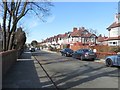
Stanley Avenue, Wallasey
A residential street with large semi detached houses on both sides of the road.
Image: © Graham Robson
Taken: 26 Mar 2018
0.08 miles
3
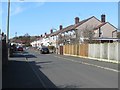
Bangor Road, Wallasey
A residential street of uniform semi detached houses in Wallasey.
Image: © Graham Robson
Taken: 26 Mar 2018
0.08 miles
4
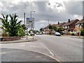
Wallasey Village, Bayswater Road
Wallasey Village is a largely residential area with a mixture of mostly 20th century semi-detached and detached housing. It is the most westerly township in Wallasey, being bordered by the suburbs of New Brighton to the north east, Liscard to the east and Poulton to the south east. Further west is Leasowe, and to the north, beyond Harrison Park, is the King's Parade fronting Liverpool Bay.
Image: © David Dixon
Taken: 6 Sep 2015
0.10 miles
6
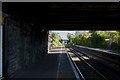
The line south from Wallasey Grove Road railway station
Image: © Ian Greig
Taken: 5 May 2017
0.12 miles
7
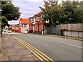
Wallasey Village, Green Lane
Wallasey Village is a largely residential area with a mixture of mostly 20th century semi-detached and detached housing. It is the most westerly township in Wallasey, being bordered by the suburbs of New Brighton to the north east, Liscard to the east and Poulton to the south east. Further west is Leasowe, and to the north, beyond Harrison Park, is the King's Parade fronting Liverpool Bay.
Image: © David Dixon
Taken: 6 Sep 2015
0.13 miles
8
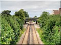
Wallasey Grove Road Railway Station
Wallasey Grove Road railway station (viewed here from the bridge at Green Lane) is situated on the Wirral Line 6½ miles west of Liverpool Lime Street on the Merseyrail network. The station was built on the Wirral Railway's route from Birkenhead Park to New Brighton, opening in 1888. Through services via the Mersey Railway Tunnel to Liverpool commenced in 1938, when the London Midland and Scottish Railway electrified the line.
Image: © David Dixon
Taken: 6 Sep 2015
0.13 miles
9
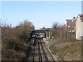
Wallasey Merseyrail Station
Looking north from a bridge carrying Green Lane across the track towards Wallasey Merseyrail Station.
Image: © Graham Robson
Taken: 26 Mar 2018
0.13 miles
10
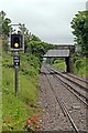
Signal and road bridge, Wallasey
Viewed from the end of the Liverpool-bound platform at Wallasey Grove Road railway station, signal ML604R is in front of Green Lane road bridge. Behind the road bridge, Wallasey Village station is in view.
Image: © El Pollock
Taken: 8 Jun 2012
0.13 miles