
IMAGES TAKEN NEAR TO
Brookthorpe Close, WALLASEY, CH45 7SH
Introduction
This page details the photographs taken nearby to Brookthorpe Close, CH45 7SH by members of the Geograph project.
The Geograph project started in 2005 with the aim of publishing, organising and preserving representative images for every square kilometre of Great Britain, Ireland and the Isle of Man.

There are currently over 7.5m images from over14,400 individuals and you can help contribute to the project by visiting https://www.geograph.org.uk
Image Map
Images are licensed for reuse under creativecommons.org/licenses/by-sa/2.0
Notes
- Clicking on the map will re-center to the selected point.
- The higher the marker number, the further away the image location is from the centre of the postcode.
Image Listing (25 Images Found)
Images are licensed for reuse under creativecommons.org/licenses/by-sa/2.0
Image
Details
Distance
1
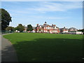
Liscard Primary School
Liscard Primary School in Withens Lane.
Image: © Sue Adair
Taken: 24 Aug 2019
0.08 miles
2
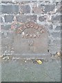
Old Milepost by Penkett Road, Liscard
Cast-iron post on the UC road, Wallasey, Merseyside; Penkett Road, No. 41 against front wall, South-West side of road. C19, probably erected by the Wallasey Local Board in connection with goods or passenger transport.
Inscription reads:-
SEACOMBE
FERRY
M
1½
Milestone Society ID: CH_SCF01A.
Image: © Milestone Society
Taken: 4 Jul 2018
0.11 miles
4
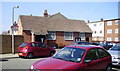
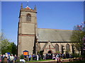
Wallasey Spiritualist Church
On Withens Lane, in Wallasey.
Image: © Eirian Evans
Taken: 17 Apr 2011
0.13 miles
5
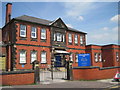
Wallasey Masonic Hall
Wallasey Masonic Hall was built in 1911 designed by was JWB Harding FSA of Liverpool.
Image: © Sue Adair
Taken: 13 May 2019
0.15 miles
6
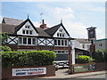
Saddle Inn Withins Lane
Originally named The Horse and Saddle Inn, it was once two separate cottages built about 1830. Yate's Brewery of Birkenhead purchased it for £750 in 1881 and most likely to have converted the cottages to a pub.
Image: © Sue Adair
Taken: 13 May 2019
0.19 miles
7
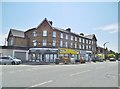
Liscard, shopping parade
On Rake Lane. Current occupants: pharmacy, convenience store, Chinese take-away, hairdressers, paint strippers.
Image: © Mike Faherty
Taken: 4 Jul 2018
0.19 miles
8
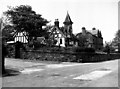
The Tudor Cafe, Egremont, Wirral, Cheshire
Back in 1951, this pleasant and welcoming mock-Tudor style cafe would provide a nice cup of tea and piece of chocolate cake (or something more substantial if you wanted it) for the stroller along Egremont Promenade. I wonder if it's still there, although I doubt it - it's probably been replaced by a McDonald's or Burger King.
Image: © Dr Neil Clifton
Taken: 19 May 1951
0.21 miles
9
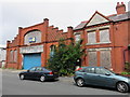
Liscard former Drill Hall and house (2)
Looking across Urmson Road towards the former drill hall and attached house on the right. See also Image and Image
Image: © John S Turner
Taken: 29 Jul 2014
0.21 miles
10
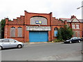
Liscard former Drill Hall and house
Looking across Urmson Road towards the former drill hall and attached house. The building is first recorded on the 1911 O.S. map where the former Townfield Lane has been renamed Urmson Road. In more recent years the building was used as a tyre fitting garage, but now it is boarded up, has holes in the windows, and appears to be disused, which is a pity for such a finely designed frontage. See also Image and Image
Image: © John S Turner
Taken: 29 Jul 2014
0.21 miles