
IMAGES TAKEN NEAR TO
Wheatland Lane, WALLASEY, CH44 7LD
Introduction
This page details the photographs taken nearby to Wheatland Lane, CH44 7LD by members of the Geograph project.
The Geograph project started in 2005 with the aim of publishing, organising and preserving representative images for every square kilometre of Great Britain, Ireland and the Isle of Man.

There are currently over 7.5m images from over14,400 individuals and you can help contribute to the project by visiting https://www.geograph.org.uk
Image Map
Images are licensed for reuse under creativecommons.org/licenses/by-sa/2.0
Notes
- Clicking on the map will re-center to the selected point.
- The higher the marker number, the further away the image location is from the centre of the postcode.
Image Listing (22 Images Found)
Images are licensed for reuse under creativecommons.org/licenses/by-sa/2.0
Image
Details
Distance
1
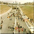
Kingsway Tunnel Public Walk
The Kingsway Tunnel linking Liverpool with Wallasey was officially opened by Queen Elizabeth II on 24th of June 1971. On the Sunday after the official opening (27th of June) the tunnel was made available to the public to walk through. Tickets cost 25p for an adult and 10p for a child which included a return trip on the Mersey ferry.
Image: © Sue Adair
Taken: 27 Jun 1971
0.15 miles
2
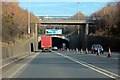
Kingsway Tunnel Entrance, Wallasey
The road bridge in the foreground is Wheatland Lane.
Image: © El Pollock
Taken: 1 Mar 2012
0.15 miles
3
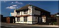
Dock Road
Disused buildings on Dock Road.
Image: © Peter McDermott
Taken: 25 May 2017
0.20 miles
4
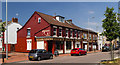
Dot's Diner
Dot's Diner on Birkenhead Road.
Image: © Peter McDermott
Taken: 25 May 2017
0.20 miles
5
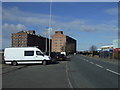
Dock Road (A5139)
Heading east towards Wallasey.
Image: © JThomas
Taken: 1 Mar 2014
0.20 miles
7
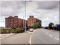
Seacombe, Dock Road and East Float Quay
Former grain warehouses built in 1868, now converted into apartments. Grade II listed (English Heritage Building ID: 443666 http://www.britishlistedbuildings.co.uk/en-443666-grain-warehouse-to-south-of-grain-wareho#.VbwFuHnbKHs British Listed Buildings)
Image: © David Dixon
Taken: 30 Jul 2015
0.22 miles
8
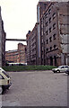
Corn warehouses, Dock Road, Wallasey
Three massive warehouses built in 1868 by G F Lyster and are alongside the East Float. Only one and a half remain in 2021 and have been converted to luxury flats. They are six storeys high and of brick with heavily moulded windows and doors.
I was there to visit the little fleet of historic warships, including two veterans of the Falklands War. They have now been disbanded and largely scrapped.
Image: © Chris Allen
Taken: Unknown
0.22 miles
9
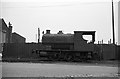
'Brian' on Birkenhead Road, Seacombe ? 1964
Out of service and awaiting scrapping. Built by Avonside Engine Co of Bristol in 1918 (works no.1796), it was one of a number of locomotives owned by the Wrexham engineering firm Cudworth and Johnson and hired out to various businesses, in this instance Rea Ltd who carried out a lot of wharfage, as well as river tugs.
A very similar engine to this, which is now preserved https://preservedbritishsteamlocomotives.com/avonside-engine-co-works-no-1772-askham-hall-0-4-0st/
Image: © Alan Murray-Rust
Taken: Unknown
0.23 miles
10

Singhsbury's Seacombe
Singhsbury's, St. Paul's Road, Wallasey.
Image: © Arthur C Harris
Taken: 21 Apr 2024
0.23 miles