
IMAGES TAKEN NEAR TO
Norwood Road, WALLASEY, CH44 4EG
Introduction
This page details the photographs taken nearby to Norwood Road, CH44 4EG by members of the Geograph project.
The Geograph project started in 2005 with the aim of publishing, organising and preserving representative images for every square kilometre of Great Britain, Ireland and the Isle of Man.

There are currently over 7.5m images from over14,400 individuals and you can help contribute to the project by visiting https://www.geograph.org.uk
Image Map
Images are licensed for reuse under creativecommons.org/licenses/by-sa/2.0
Notes
- Clicking on the map will re-center to the selected point.
- The higher the marker number, the further away the image location is from the centre of the postcode.
Image Listing (6 Images Found)
Images are licensed for reuse under creativecommons.org/licenses/by-sa/2.0
Image
Details
Distance
1
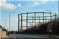
Gasholder, Kingsway Tunnel Approach
The cutting, which the road is situated in, was once part of the Seacombe & Poulton railway line.
Image: © El Pollock
Taken: 1 Mar 2012
0.04 miles
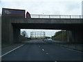
3
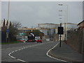
Bulk Storage
Storage tanks viewed from Dock Road, adjacent the West Float.
Image: © J Scott
Taken: 12 Nov 2010
0.19 miles
4
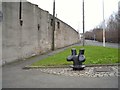
Old bollard on Limekiln Lane
This old bollard and the characterful wall of a half-demolished warehouse combine to give an element of interest to what could have been a rather nondescript scene.
Image: © Antony Dixon
Taken: 20 Feb 2012
0.20 miles
6
West Float
Entrance to West Float Industrial Estate off the Dock Road.
Image: © J Scott
Taken: 12 Nov 2010
0.24 miles