
IMAGES TAKEN NEAR TO
Manor Road, WALLASEY, CH44 1DA
Introduction
This page details the photographs taken nearby to Manor Road, CH44 1DA by members of the Geograph project.
The Geograph project started in 2005 with the aim of publishing, organising and preserving representative images for every square kilometre of Great Britain, Ireland and the Isle of Man.

There are currently over 7.5m images from over14,400 individuals and you can help contribute to the project by visiting https://www.geograph.org.uk
Image Map
Images are licensed for reuse under creativecommons.org/licenses/by-sa/2.0
Notes
- Clicking on the map will re-center to the selected point.
- The higher the marker number, the further away the image location is from the centre of the postcode.
Image Listing (30 Images Found)
Images are licensed for reuse under creativecommons.org/licenses/by-sa/2.0
Image
Details
Distance
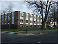
2
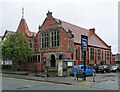
Chapel, Manor Road, Wallasey
By Edmund Ware and Edmund Rathbone, 1898-99. Grade II* listed.
Image: © Stephen Richards
Taken: 22 Aug 2014
0.04 miles
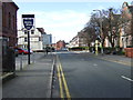
4
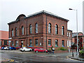
72 Grosvenor Street, Wallasey
Distinctive brick box.
Now the Regency Suite - function rooms, bar, restaurant etc.
Image: © Stephen Richards
Taken: 22 Aug 2014
0.06 miles
5
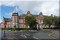
Former police station, Manor Road, Wallasey
Built c1890 and including courts.
At the time possibly still in use by Wirral Council, but probably since converted to flats.
Image: © Stephen Richards
Taken: 22 Aug 2014
0.07 miles
6
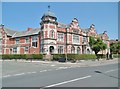
Liscard, Old Courthouse
On Manor Road, former police station and courthouse, built 1900; now residential. https://www.liverpoolecho.co.uk/news/liverpool-news/step-inside-wallaseys-historic-former-10679797
Image: © Mike Faherty
Taken: 4 Jul 2018
0.07 miles
7
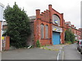
Liscard former Drill Hall and house (3)
Looking along the curved Urmson Road towards the west side and front of the former drill hall. See also: Image and Image
Image: © John S Turner
Taken: 29 Jul 2014
0.08 miles
8
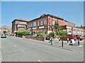
Liscard, Grosvenor Ballroom
On Grosvenor Street; venue with community facilities: http://www.grosvenorballroom.co.uk/
Image: © Mike Faherty
Taken: 4 Jul 2018
0.08 miles
9
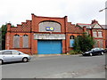
Liscard former Drill Hall and house
Looking across Urmson Road towards the former drill hall and attached house. The building is first recorded on the 1911 O.S. map where the former Townfield Lane has been renamed Urmson Road. In more recent years the building was used as a tyre fitting garage, but now it is boarded up, has holes in the windows, and appears to be disused, which is a pity for such a finely designed frontage. See also Image and Image
Image: © John S Turner
Taken: 29 Jul 2014
0.08 miles
10
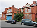
Liscard former Drill Hall and house (2)
Looking across Urmson Road towards the former drill hall and attached house on the right. See also Image and Image
Image: © John S Turner
Taken: 29 Jul 2014
0.08 miles