
IMAGES TAKEN NEAR TO
Serpentine Road, WALLASEY, CH44 0AX
Introduction
This page details the photographs taken nearby to Serpentine Road, CH44 0AX by members of the Geograph project.
The Geograph project started in 2005 with the aim of publishing, organising and preserving representative images for every square kilometre of Great Britain, Ireland and the Isle of Man.

There are currently over 7.5m images from over14,400 individuals and you can help contribute to the project by visiting https://www.geograph.org.uk
Image Map
Images are licensed for reuse under creativecommons.org/licenses/by-sa/2.0
Notes
- Clicking on the map will re-center to the selected point.
- The higher the marker number, the further away the image location is from the centre of the postcode.
Image Listing (17 Images Found)
Images are licensed for reuse under creativecommons.org/licenses/by-sa/2.0
Image
Details
Distance
1
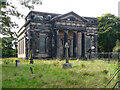
St John, Liscard Road, Wallasey
The noble, and blackened, Doric front dates from 1832-33, the only known work of Henry Turberville Edwards, for Sir John Tobin. They never got round to the steeple. The Storeton stone used for the front ends abruptly on the returns. Grade II listed.
Repaired after bomb damage in 1942, but redundant since 2004 and inaccessible.
Image: © Stephen Richards
Taken: 22 Aug 2014
0.10 miles
2
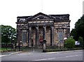
St. John's Church, Liscard Road, Egremont
Situated next to Central Park, opposite Church Street.
Image: © El Pollock
Taken: 22 Jul 2009
0.10 miles
3
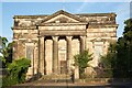
St John's Church, Egremont
St John's was built in 1832–33, and was designed by Henry Turberville Edwards; it is his only known work. The church was built on land owned by Sir John Tobin, whose son became the first vicar. The church was consecrated on 31 October 1831 by the Rt. Revd. John Bird Sumner, bishop of Chester, and it opened for worship on 19 May 1833. In 1881 it was restored by Cornelius Sherlock; this included removing the galleries, replacing box pews with benches, moving the organ, enclosing the chancel, and adding two new windows. In 1942 the church was damaged by a bomb blast, and was repaired in the 1950s with a new roof. It was declared redundant on 1 July 2004, and approval for conversion into residential use was agreed on 6 December 2006. As of August 2018 the church was put into private ownership with the intention of reopening it as Church again.
* Courtesy Wikipedia
Image: © Arthur C Harris
Taken: 21 Jun 2022
0.10 miles
4

St John's Church, Wallasey
No longer used for worship,St John's Church, Liscard Road, Wallasey, pictured from Central Park looking rather sad.
Image: © Arthur C Harris
Taken: 31 Aug 2025
0.11 miles
5
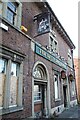
The Kings Arms Hotel, Liscard
No longer in business.
Image: © Arthur C Harris
Taken: 21 Jun 2022
0.12 miles
6
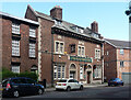
Former pub, Liscard Road, Wallasey
The King's Arms Hotel, a handsome neo-Georgian building in brick with stone trim.
It was open in 2007, when there was a drugs bust, but appears to have closed by 2012.
Image: © Stephen Richards
Taken: 22 Aug 2014
0.13 miles

8
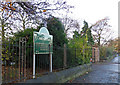
Central Perk
Liscard Road entrance to Central Park, Liscard.
Image: © J Scott
Taken: 21 Nov 2010
0.15 miles
9
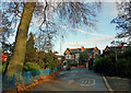
Faded Marks
Central Park exit to Liscard Road, Liscard.
Image: © J Scott
Taken: 21 Nov 2010
0.17 miles
10
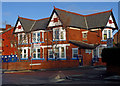
Lyn's Little Ones
Pre school nursery, corner of Central Park Avenue and Liscard Road, Liscard.
Image: © J Scott
Taken: 21 Nov 2010
0.17 miles