
IMAGES TAKEN NEAR TO
Larne Drive, CHESTER, CH4 0QF
Introduction
This page details the photographs taken nearby to Larne Drive, CH4 0QF by members of the Geograph project.
The Geograph project started in 2005 with the aim of publishing, organising and preserving representative images for every square kilometre of Great Britain, Ireland and the Isle of Man.

There are currently over 7.5m images from over14,400 individuals and you can help contribute to the project by visiting https://www.geograph.org.uk
Image Map
Images are licensed for reuse under creativecommons.org/licenses/by-sa/2.0
Notes
- Clicking on the map will re-center to the selected point.
- The higher the marker number, the further away the image location is from the centre of the postcode.
Image Listing (46 Images Found)
Images are licensed for reuse under creativecommons.org/licenses/by-sa/2.0
Image
Details
Distance
1
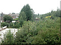
New use for old railway
Gardens on the site of a dismantled railway line.
Image: © Dennis Turner
Taken: 31 Aug 2005
0.01 miles
2
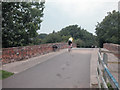
New use for railway bridge.
Carrying a bridleway over a dismantled railway and linking a residential area to a Broughton Retail Park.
Image: © Dennis Turner
Taken: 31 Aug 2005
0.06 miles
3
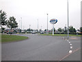
Broughton Shopping Park
Retail park between Broughton aircraft factory and A55 trunk road.
Image: © Dennis Turner
Taken: 31 Aug 2005
0.07 miles
4
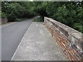
Broughton railway bridge and bridleway
The old road to Broughton from Bretton is now only a bridleway over the redundant railway bridge. On the far right of the photo the remains of a damaged bench mark can be seen - see Image
Image: © John S Turner
Taken: 8 Sep 2009
0.07 miles
5
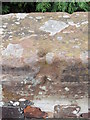
Damaged bench mark on Broughton railway bridge
This old rivet bench mark on the north side of the bridge has been almost completely destroyed. A bench mark was recorded at this location on the 1869 O.S. map.
Image: © John S Turner
Taken: 8 Sep 2009
0.08 miles
6
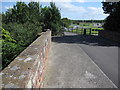
Broughton railway bridge and bridleway to the shopping park
The old railway bridge once carried the minor road between Broughton and Bretton over the Mold Junction line. The line was closed in the 1960s and the road has now been cut through by the A55 links. Nevertheless, the bridge still provides an important bridleway route to the shopping park behind the trees, and onwards to the old road to Bretton. The small dark mark on the parapet is the remains of a damaged rivet bench mark - see Image
Image: © John S Turner
Taken: 9 Sep 2009
0.08 miles
7
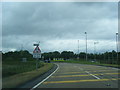
Bretton roundabout exit from North Wales Expressway
Image: © Colin Pyle
Taken: 16 Jun 2012
0.12 miles
8
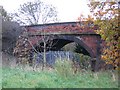
Broughton Railway Bridge
The bridge over the railway line, now disused, which went from Mold Junction at Saltney to Mold. The bridge used to carry the back lane from Broughton to Bretton, however, the developments of the Broughton retail park, and the A55 link from Broughton, have reduced it to a bridleway.
Image: © John S Turner
Taken: 15 Nov 2006
0.12 miles
9

Modern Facsimile Milestone by the A5104, Chester Road, Broughton
By the A5104, in parish of Broughton and Bretton (Flintshire District), Chester Road, Broughton, 50m East of junction with Broughton Hall Road, against wall. An earlier photograph can be found here https://www.geograph.org.uk/photo/6045489.
Inscription reads:-
TO / MOLD / 7½ MILES : : FLINTSHIRE / C.C. / 1890 : : TO / CHESTER / 4 MILES
Milestone Society National ID: FLT_CHMD04
Image: © John Turner
Taken: 13 Feb 2017
0.15 miles
10
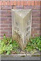
Modern Facsimile Milestone by the A5104, Chester Road, Broughton
By the A5104, in parish of Broughton and Bretton (Flintshire District), Chester Road, Broughton, 50m East of junction with Broughton Hall Road, against wall.
Inscription reads:- : TO / MOLD / 7½ MILES : : FLINTSHIRE / C.C. / 1890 : : TO / CHESTER / 4 MILES :
Surveyed
Milestone Society National ID: FLT_CHMD04
Image: © Milestone Society
Taken: Unknown
0.15 miles