
IMAGES TAKEN NEAR TO
Aughton Way, CHESTER, CH4 0QE
Introduction
This page details the photographs taken nearby to Aughton Way, CH4 0QE by members of the Geograph project.
The Geograph project started in 2005 with the aim of publishing, organising and preserving representative images for every square kilometre of Great Britain, Ireland and the Isle of Man.

There are currently over 7.5m images from over14,400 individuals and you can help contribute to the project by visiting https://www.geograph.org.uk
Image Map
Images are licensed for reuse under creativecommons.org/licenses/by-sa/2.0
Notes
- Clicking on the map will re-center to the selected point.
- The higher the marker number, the further away the image location is from the centre of the postcode.
Image Listing (36 Images Found)
Images are licensed for reuse under creativecommons.org/licenses/by-sa/2.0
Image
Details
Distance
1
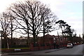
Cledwen Road, Broughton
Suburbs of Chester.
Image: © Eirian Evans
Taken: 7 Dec 2007
0.07 miles
2
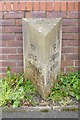
Modern Facsimile Milestone by the A5104, Chester Road, Broughton
By the A5104, in parish of Broughton and Bretton (Flintshire District), Chester Road, Broughton, 50m East of junction with Broughton Hall Road, against wall.
Inscription reads:- : TO / MOLD / 7½ MILES : : FLINTSHIRE / C.C. / 1890 : : TO / CHESTER / 4 MILES :
Surveyed
Milestone Society National ID: FLT_CHMD04
Image: © Milestone Society
Taken: Unknown
0.08 miles
3

Modern Facsimile Milestone by the A5104, Chester Road, Broughton
By the A5104, in parish of Broughton and Bretton (Flintshire District), Chester Road, Broughton, 50m East of junction with Broughton Hall Road, against wall. An earlier photograph can be found here https://www.geograph.org.uk/photo/6045489.
Inscription reads:-
TO / MOLD / 7½ MILES : : FLINTSHIRE / C.C. / 1890 : : TO / CHESTER / 4 MILES
Milestone Society National ID: FLT_CHMD04
Image: © John Turner
Taken: 13 Feb 2017
0.08 miles
4
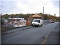
Just too late
This was the site of the Broughton V.P. School on Broughton Hall Road, which was built after 1881 and demolished circa 2006. The site is now being developed for much needed executive housing. Hopefully someone has a photo of the old building? The A55 link-road underpass can just be seen at the far right.
Image: © John S Turner
Taken: 15 Nov 2006
0.08 miles
5
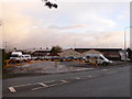
Entrance to the Airbus factory, Broughton
The Broughton site is responsible for assembling the wings for all Airbus aircraft. It employs more than 5,000 people, most in manufacturing and the rest in engineering and support.After assembly at Broughton, the wings of the A380 are transported singly by road and then river craft to Mostyn harbour, where they are loaded onto the specially-built roll-on, roll-off ferry which takes them to France.
Image: © Eirian Evans
Taken: 7 Dec 2007
0.08 miles
6
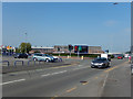
Chester Road, Broughton
Traffic lights on the A5104 allow access to the Airbus factory. The lay-by in the foreground is a bus stop.
Image: © Stephen McKay
Taken: 28 Jun 2019
0.09 miles
7
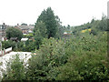
New use for old railway
Gardens on the site of a dismantled railway line.
Image: © Dennis Turner
Taken: 31 Aug 2005
0.11 miles
8
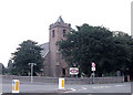
St Mary's Church Broughton
In the rectorial benefice of Hawarden. Due to the height of the church tower and the church's close proximity to the nearby Hawarden airport, the tower carries a red warning beacon light.
Image: © Dennis Turner
Taken: 31 Aug 2005
0.12 miles
9
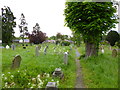
Broughton, churchyard
At St. Mary's, Broughton and Bretton, Image
Image: © Mike Faherty
Taken: 17 May 2012
0.12 miles
10
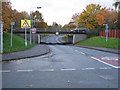
Broughton underpass
Broughton Hall Road was lowered to go under the newer A55 link road. Despite all the warning signs and the automated flashing lights (height sensor post at far left of picture) many vans have come to grief at this point. Note the black and yellow markings on the left hand side of the bridge are pale and worn whereas those on the right are good as new!
Image: © John S Turner
Taken: 15 Nov 2006
0.12 miles